Laponia
Padjelanta, Sarek, Stora Sjöfallet and Muddus—names that resonate deeply with hikers. Together with the Sjaunja and Stubba nature reserves, these four national parks form the Laponia World Heritage Site, an area as large as three Gotlands.
Padjelanta
The western part of Laponia, Padjelanta, is a gently rolling mountain plateau with large lakes. Its unique plant life makes it especially popular among botanists. There is a marked summer trail and mountain cabins, making the area more accessible for hikers. The Padjelanta Trail runs through the west and south, offering a popular route for experiencing this vast landscape.
Sarek
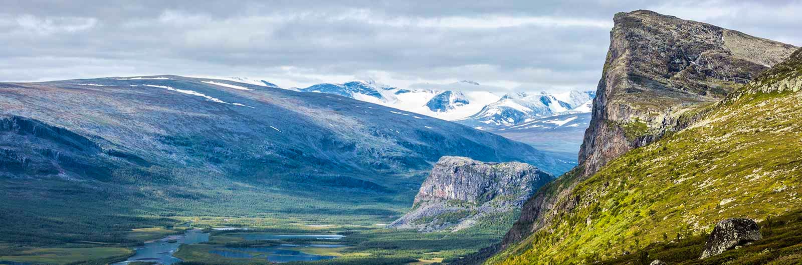
In Sarek, the central part of Laponia, around a hundred high peaks rise dramatically, many of them with glaciers. Deep valleys and rushing streams wind their way between the mountains. If you’re looking for a true wilderness experience, Sarek—often called Europe’s largest wilderness—is the place to go. However, hiking here requires experience, as there are no marked trails, accommodation or facilities. Trails and cabins do, however, surround Sarek. The King’s Trail (Kungsleden) runs along the eastern side and continues north towards the Kebnekaise Mountains.
Stora Sjöfallet
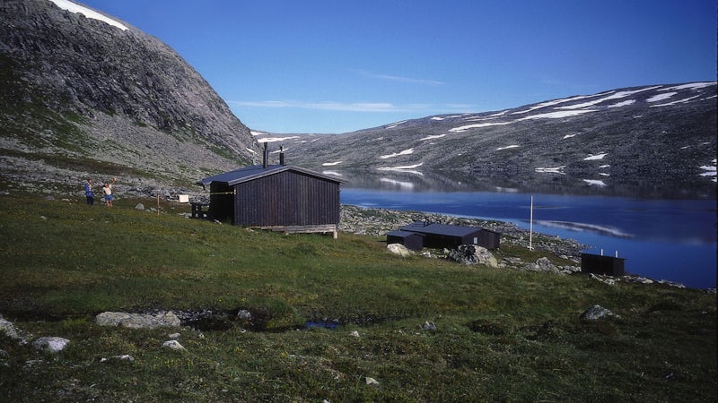
Stora Sjöfallet National Park is located in the southeastern part of Laponia and was originally known for its powerful waterfall of the same name. Due to hydropower development, the water flow is now significantly reduced, but the area still offers spectacular mountain views, deep valleys and large lakes. The park is an important part of the Sámi cultural landscape, and you can visit Naturum Laponia to learn more about its nature and history.
Muddus
Muddus National Park, located in the northern and eastern parts of Laponia, is known for its vast forests, deep wetlands and high cliffs. The untouched pine forest is several hundred years old and has never been logged, making Muddus one of Sweden’s most valuable old-growth forests. The park also features impressive ravines and waterfalls, such as Muddusfallet. Muddus is the most accessible part of Laponia, with several marked trails, making it ideal for day hikes as well as longer trips.
Learn more about how to avoid disturbing the reindeer.
All trails in the area
Book accommodation in Laponia


Activities in Laponia

Map of Laponia
Navigate past map or other external content.This map is a planning tool and should not replace a physical map and compass. The service “Naturkartan” (opens in new tab) is operated by a company called “Outdoor map”. Please note that trail information is owned and updated by the respective trail administrator (e.g. municipality or county administrative board).
Visitor calendar
Do you prefer a quieter experience in the mountains? Our visitor calendar gives you an overview of typical occupancy levels in this mountain area, helping you plan your trip during less busy periods. During quieter times, we also often offer better prices. Please note that the visitor calendar is only an indication and does not account for variations due to events or holidays.
Week |
24 |
25 |
26 |
27 |
28 |
29 |
30 |
31 |
32 |
33 |
34 |
35 |
36 |
37 |
38 |
39 |
|---|---|---|---|---|---|---|---|---|---|---|---|---|---|---|---|---|
Saltoluokta |
Few visitors |
More visitors Thurs-Sat |
Few visitors |
Few visitors |
Most visitors |
Most visitors |
Most visitors |
Most visitors |
Most visitors |
Most visitors |
More visitors Thurs-Sat |
More visitors Thurs-Sat |
More visitors Thurs-Sat |
More visitors Thurs-Sat |
Closed |
Closed |
Kvikkjokk |
Few visitors |
Few visitors |
Few visitors |
Few visitors |
Most visitors |
Most visitors |
Most visitors |
Most visitors |
Most visitors |
Most visitors |
Few visitors |
Few visitors |
Few visitors |
Few visitors |
Few visitors |
Few visitors |
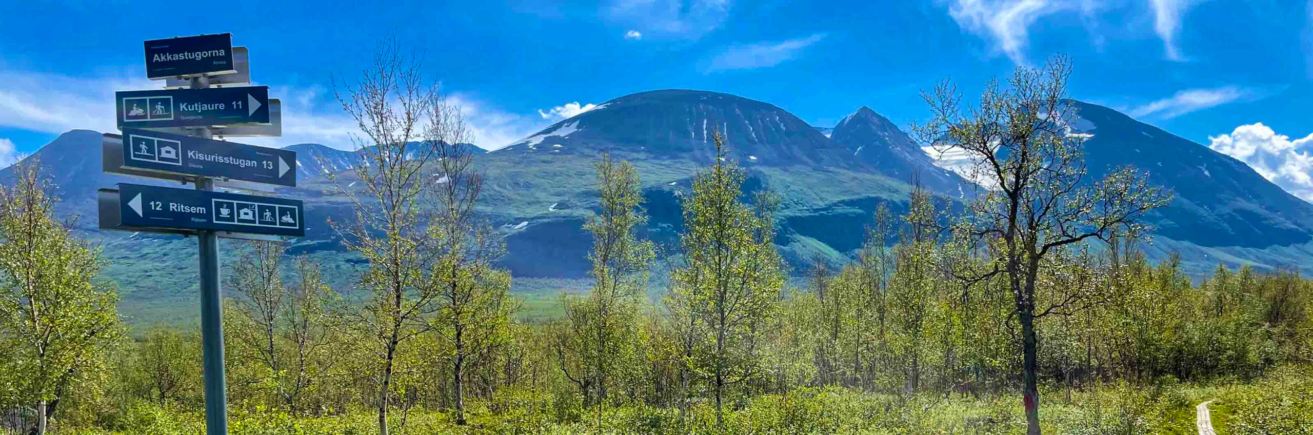
Ritsem |
Closed |
Few visitors |
Few visitors |
Few visitors |
More visitors |
More visitors |
Most visitors |
Most visitors |
More visitors |
More visitors |
Few visitors |
Few visitors |
Few visitors |
Closed |
Closed |
Closed |
Aktse |
Closed |
Few visitors |
Few visitors |
Few visitors |
More visitors |
More visitors |
Most visitors |
Most visitors |
More visitors |
More visitors |
More visitors Thurs-Sat |
More visitors Thurs-Sat |
More visitors Thurs-Sat |
More visitors Thurs-Sat |
Closed |
Closed |
Akka |
Closed |
Closed |
Few visitors |
Few visitors |
More visitors |
More visitors |
Most visitors |
Most visitors |
Few visitors |
Few visitors |
Few visitors |
Few visitors |
Few visitors |
Closed |
Closed |
Closed |
Sitojaure |
Closed |
Few visitors |
Few visitors |
Few visitors |
More visitors |
More visitors |
Most visitors |
Most visitors |
More visitors |
More visitors |
Few visitors |
Few visitors |
Few visitors |
Few visitors |
Closed |
Closed |
Vakkotavare |
Closed |
Few visitors |
Few visitors |
Few visitors |
More visitors |
More visitors |
Most visitors |
Most visitors |
More visitors |
More visitors |
Few visitors |
Few visitors |
Few visitors |
Few visitors |
Closed |
Closed |
Pårte |
Closed |
Few visitors |
Few visitors |
Few visitors |
More visitors |
More visitors |
Most visitors |
Most visitors |
More visitors |
More visitors |
Few visitors |
Few visitors |
Few visitors |
Few visitors |
Closed |
Closed |
Kutjaure |
Closed |
Closed |
Closed |
Few visitors |
More visitors |
More visitors |
Most visitors |
Most visitors |
Few visitors |
Few visitors |
Few visitors |
Few visitors |
Few visitors |
Closed |
Closed |
Closed |
Teusajaure |
Closed |
Few visitors |
Few visitors |
Few visitors |
More visitors |
More visitors |
Most visitors |
Most visitors |
More visitors |
More visitors |
Few visitors |
Few visitors |
Few visitors |
Few visitors |
Closed |
Closed |
Vaisaluokta |
Closed |
Closed |
Few visitors |
Few visitors |
More visitors |
More visitors |
Most visitors |
Most visitors |
Few visitors |
Few visitors |
Few visitors |
Few visitors |
Few visitors |
Closed |
Closed |
Closed |
Kaitumjaure |
Closed |
Few visitors |
Few visitors |
Few visitors |
More visitors |
More visitors |
Most visitors |
Most visitors |
More visitors |
More visitors |
Few visitors |
Few visitors |
Few visitors |
Few visitors |
Closed |
Closed |
Njunjes |
Closed |
Closed |
Few visitors |
Few visitors |
Few visitors |
Few visitors |
More visitors |
More visitors |
Few visitors |
Few visitors |
Few visitors |
Few visitors |
Few visitors |
Closed |
Closed |
Closed |
Såmmarlappa |
Closed |
Closed |
Few visitors |
Few visitors |
Few visitors |
Few visitors |
More visitors |
More visitors |
Few visitors |
Few visitors |
Few visitors |
Few visitors |
Few visitors |
Closed |
Closed |
Closed |
Pieskehaure |
Closed |
Closed |
Closed |
Few visitors |
Few visitors |
Few visitors |
Few visitors |
Few visitors |
Few visitors |
Few visitors |
Few visitors |
Few visitors |
Closed |
Closed |
Closed |
Closed |
Sårjåsjaure |
Few visitors |
Few visitors |
Few visitors |
Few visitors |
Few visitors |
Few visitors |
Few visitors |
Few visitors |
Few visitors |
Few visitors |
Few visitors |
Few visitors |
Few visitors |
Few visitors |
Few visitors |
Few visitors |
Tarrekaise |
Closed |
Closed |
Few visitors |
Few visitors |
Few visitors |
Few visitors |
More visitors |
More visitors |
Few visitors |
Few visitors |
Few visitors |
Few visitors |
Few visitors |
Closed |
Closed |
Closed |
Vaimok |
Closed |
Closed |
Closed |
Few visitors |
Few visitors |
Few visitors |
Few visitors |
Few visitors |
Few visitors |
Few visitors |
Few visitors |
Few visitors |
Closed |
Closed |
Closed |
Closed |
Quick facts
Getting there
Bus from Murjek Jokkmokk to Kvikkjokk
Bus from Gällivare to Suorva, Vakkotavare and Ritsem
Mountain map
Calazos ”Sarek Padjelanta” 1:100 000
The tour starts here
STF Saltoluokta Mountain station, STF Kvikkjokk Mountain station, STF Ritsem or Suorva.
Read more
Laponia naturum (opens in new tab)
Länsstyrelsen Norrbotten (opens in new tab)
More hiking pages

Hiking
On this page you will find helpful tips and information for your hike.

Hiking trails in Sweden
On this page we present a selection of popular and high-quality trails across the country.

Mountain hiking
Discover hiking in the Swedish mountains, from day hikes to multi-day adventures.