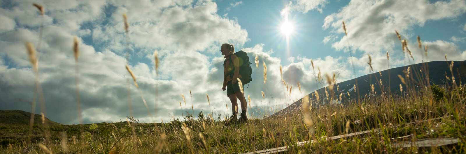
Kungsleden Kvikkjokk – Ammarnäs
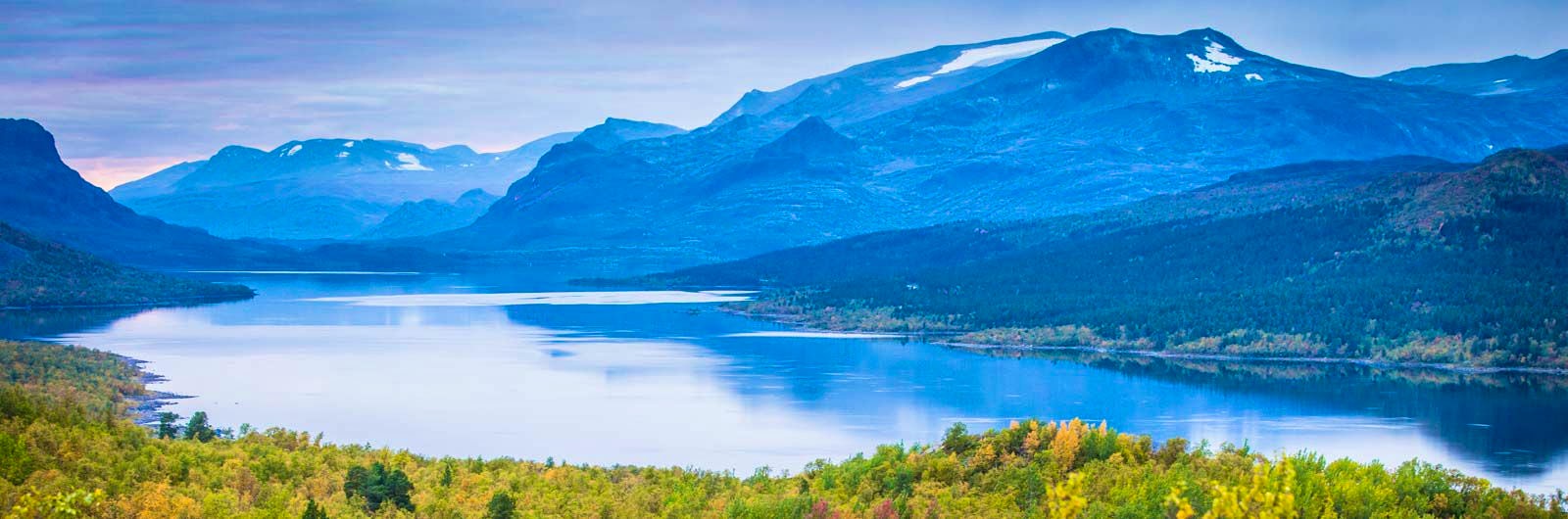
The stretch between Kvikkjokk and Ammarnäs is the least hiked part of the King’s Trail (Kungsleden) and offers a calm and magnificent experience. Here, you’ll find impressive views, especially in Pieljekaise National Park and the Vindelfjällen Nature Reserve, where vast mountain landscapes and deep valleys unfold.
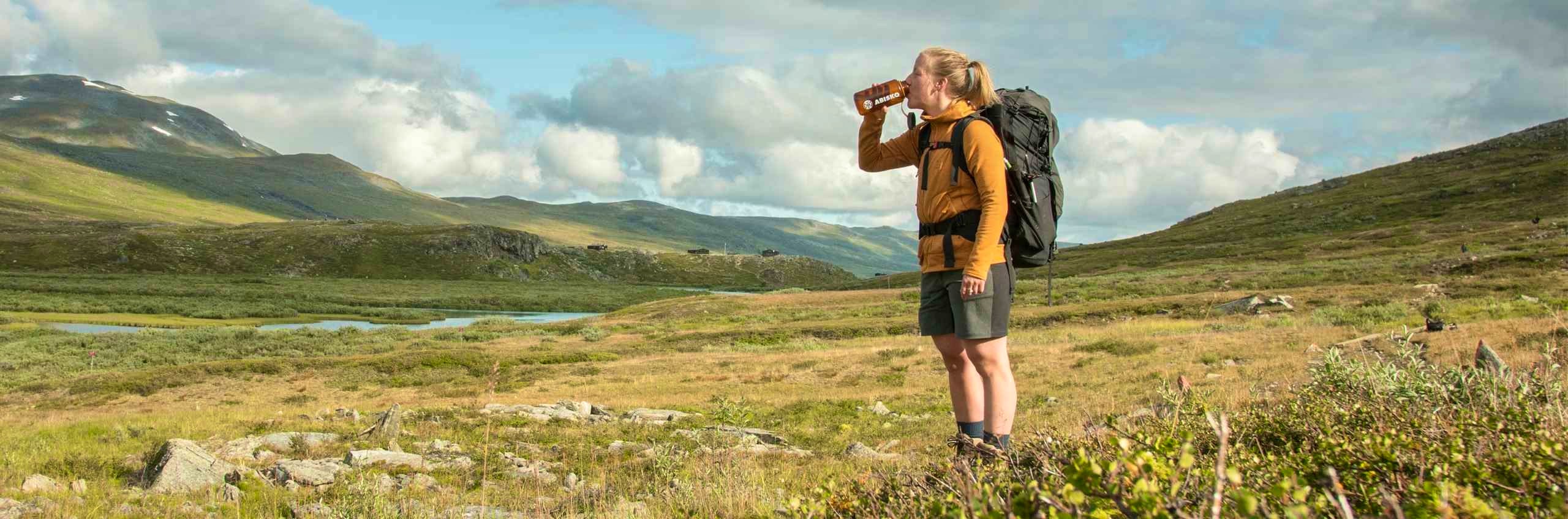
The hike is relatively demanding, with significant elevation differences between river valleys and plateaus of several hundred metres. To complete the entire stretch, you need to be prepared to camp on some nights. The trail also passes small settlements, cabins and cottages that give the area a distinct character, different from other parts of the Kungsleden.
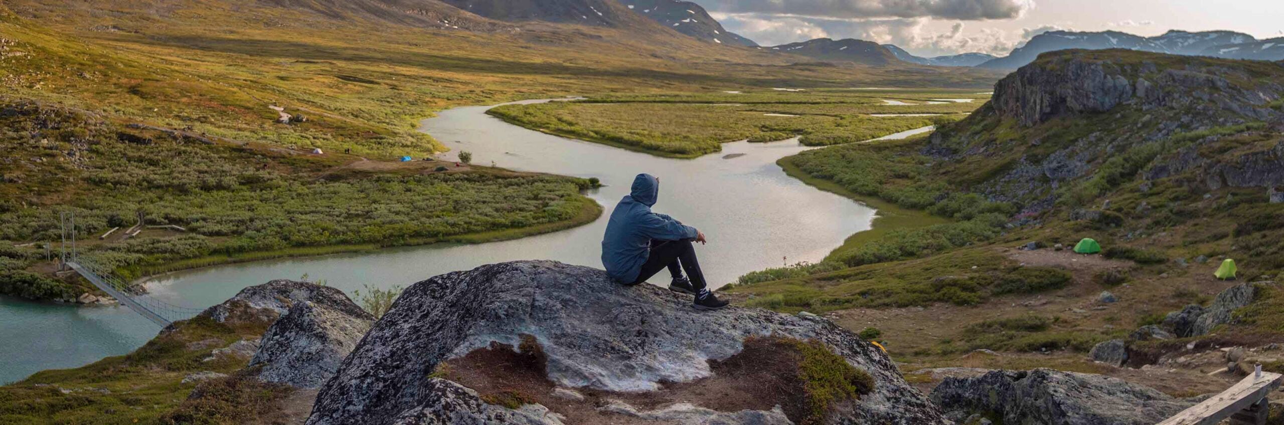
During the hike, you cross several lakes by boat, and on some sections you arrange transport on site or row yourself. The final stretch towards Ammarnäs follows a long ridge with beautiful views over the valley – a memorable ending to a varied mountain hike.
Hikes along the Kungsleden typically begin or end in Abisko, Saltoluokta, Kvikkjokk, Ammarnäs, Hemavan or Nikkaluokta.
Kvikkjokk-Ammarnäs in short
Learn more about how to avoid disturbing the reindeer.
Map of Kungsleden Kvikkjokk–Ammarnäs
Navigate past map or other external content.This map is a planning tool and should not replace a physical map and compass. The service “Naturkartan” (opens in new tab) is operated by a company called “Outdoor map”. Please note that trail information is owned and updated by the respective trail administrator (e.g. municipality or county administrative board).
Getting to the trail
Summer season: Take the train to Murjek, then transfer to direct bus 94 to Kvikkjokk.
Winter and off-season: Take the train to Murjek, Älvsbyn or Boden. Transfer to a bus towards Jokkmokk, then change to bus 47 to Kvikkjokk. Note that the bus to Kvikkjokk runs on weekdays only.
Travel to or from Ammarnäs is easiest by bus (opens in new tab) to Sorsele, and then onwards to cities such as Umeå or Skellefteå. You can also travel by bus to Östersund and connect to various train services from there.
Search for your journey from your departure point all the way to your final destination to find the best connections combining train and bus. You’ll also have travel protection, so delays won’t affect your ability to reach your destination.
Don’t miss
In Adolfström, you’ll find excellent waters for paddling if you feel like swapping your hiking boots for a while. Bird enthusiasts should not miss the Svaipa bird protection area, which is well worth a visit.

Stages Kungsleden Kvikkjokk–Ammarnäs
Stage 1: STF Kvikkjokk Mountain station–Tsielekjåkkstugan
15 km, 5–7 hours of hiking
Accommodation: Tsielekjåkkstugan
The day begins with a 3 km boat trip across Lake Sakkat, from Kvikkjokk to Mallenjarka. Information about boat transport is available at kvikkjokk-turism.se (opens in new tab) and battrafikikvikkjokk.se (opens in new tab). There are no rowing boats available here. The hike takes you through low mountain terrain, old-growth coniferous forest, and mountain birch forest. The unstaffed Tsielekjåkkstugan is open year-round and does not require pre-booking. Facilities include a stove, outdoor toilet, and emergency phone. Bed capacity is limited.
Stage 2: Tsielekjåhkå–Piteälven
19 km, 7–9 hours of hiking
Accommodation: Camping
The day begins with an easy stretch across open mountain terrain. The trail passes through the Suoŋergårsså ravine and then reaches a junction where the summer and winter trails are separated – choose the western route. You then pass the impressive cliff face Goabddábakte. The final section leads through mountain birch forest with elements of pine forest. There are no cabins along this stage, but plenty of good camping spots.
Stage 3: Piteälven–Gásakláhko
19 km, 7–9 hours of hiking
Accommodation: Camping
The hike begins along the shore of Lake Tjieggelva. After a few kilometers, the trail climbs up onto the mountain, where you hike for about 10 km across open terrain. Be careful to follow trail markings in poor weather. Gásakláhko is at a high elevation and can be a good spot for camping.
Stage 4: Gásakláhko–Vuonatjviken
13 km, 4–6 hours of hiking
Accommodation: Vuonatjviken Cabin village (opens in new tab), non-STF
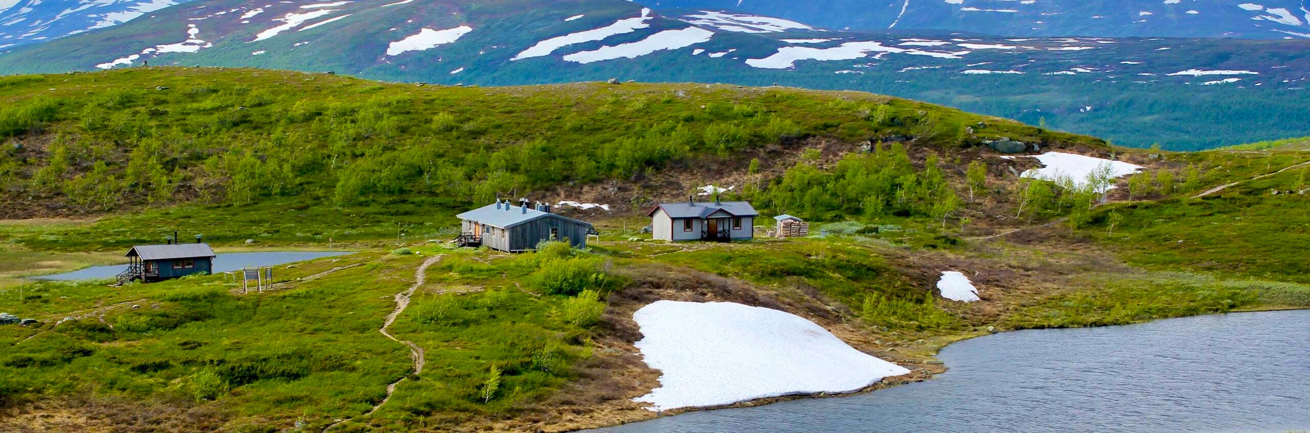
You continue across open mountain terrain for a couple of kilometers before descending into mountain birch forest near Lake Riebnes. You cross the Arctic Circle just before reaching Vuonatjviken. There is a cabin village here where you can stay overnight or put up your tent. There is also a restaurant.
Stage 5: Vuonatjviken–Jäckvik
5.4 km by boat + 18 km hiking, 4–6 hours
Accommodation: Kyrkans fjällgård Jäckvik (opens in new tab), non-STF
You begin with a boat journey across Lake Riebnes (must be booked in advance, read more about the boat service at vuonatjviken.com (opens in new tab). After crossing the lake, a steep climb through mountain birch forest awaits, followed by a few kilometres across the bare mountain landscape. The trail then descends steeply towards Lake Hornavan.
You then row across Kapellströmmarna, a distance of 400 metres. Please note that there must always be a boat on each side, which may mean that the crossing needs to be rowed three times. After the rowing crossing, around 5 kilometres remain before reaching Jäkkvik. Kyrkans Fjällgård offers hostel accommodation and tent pitches throughout the summer and is open daily. In Jäkkvik there is a well-stocked grocery store.
Stage 6: Jäckvik–Adolfström
22 km, 9–10 hours of hiking
Accommodation: Adolfström Cabin village (opens in new tab), non-STF
The day begins with hiking through herb-rich mountain birch forest, climbing the northern slope of Pieljekaise mountain. The trail is mostly easy to hike. After reaching the highest point of the stage, around 800 meters above sea level, you continue into Pieljekaise National Park. The final stretch down to Adolfström follows a gravel road. Here you’ll find a café, a local shop and cabin accommodation.
Instead of staying at Adolfström Stugby, you can also take the boat across to Bäverholmen and stay at the inn or pitch your tent there.
Stage 7: Adolfström–Sjnulttjie
23 km, 7–8 hours of hiking
Accommodation: Camping
An easy hiking stage that can be shortened by eight kilometres by taking the boat from Adolfström to Bäverholmen (opens in new tab). The boat transfer must be booked in advance. Most of the hike crosses low mountain terrain. A safety shelter is located at Sjnulttjie and is intended for temporary breaks. The shelter is equipped with a stove, firewood and an outhouse. Overnight stays and use of the available firewood are only permitted in emergency situations. There is always room in the shelter for anyone needing temporary protection from the weather. This may sometimes mean that those who have already been indoors for a while need to make space for others.
A few kilometres before the shelter at Sjnulttjie, the trail enters the Tjålmejaure bird protection area. Temporary access restrictions apply during part of the summer. You are still allowed to hike along the Kungsleden trail, but dogs must be kept on a leash and you are not permitted to leave the trail.
Stage 8: Sjnulttjie–Rävfallsstugan
27 km, 10-12 hours of hiking
Accommodation: Rävfallsstugan (not STF)
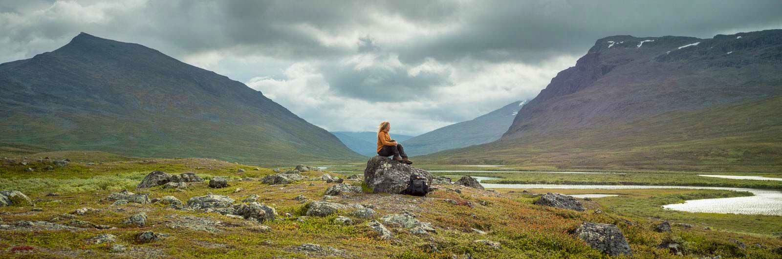
You follow the Kungsleden trail down to the County Administrative Board’s Rävfallsstugan cabin, fantastically situated by the mighty rapids of the Vindelälven river.
Stage 9: Rävfallsstugan – Ammarnäs
23 km, 8-10 hours of hiking
Accommodation: Ammarnäs Wärdshus
Follow Kungsleden along Vuotsbäcken up onto the bare mountain, then continue south towards Ammarnäs. The trail leads along a beautiful ridge with wonderful views. A shelter cabin is available along the way if you need cover. The final stretch descends along the ski slope, then you head east to reach the village.
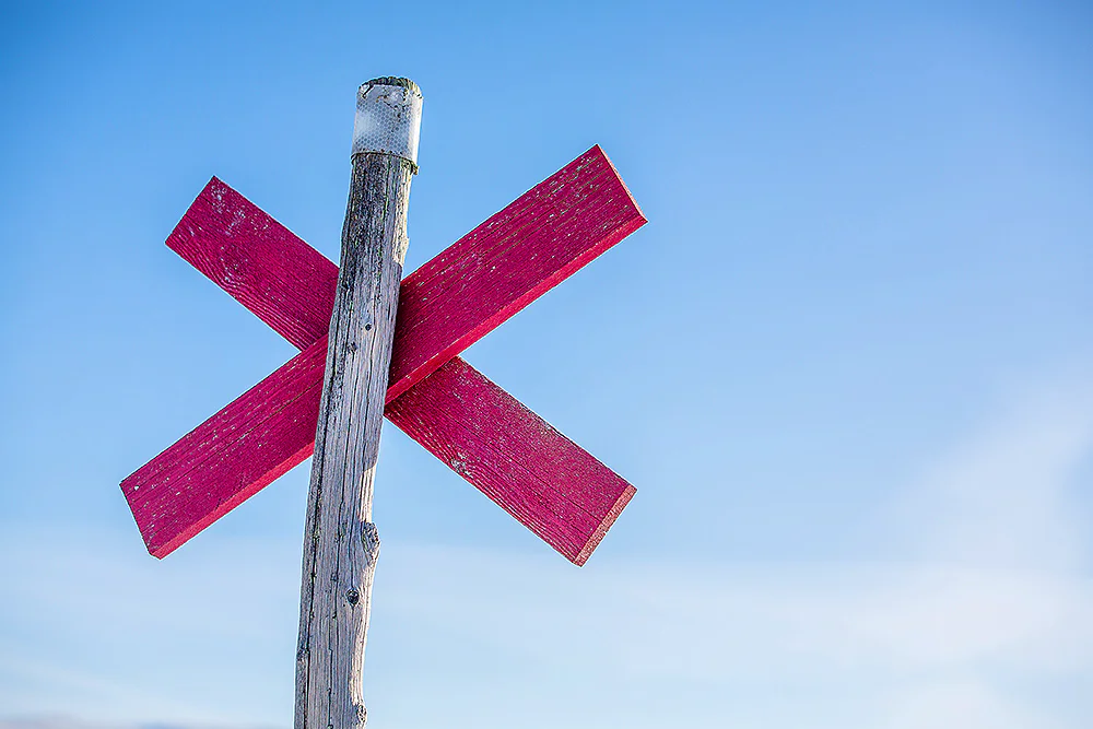
Trail markings
Check the trail markings before you set out. Winter trails are marked with crosses, while summer trails are marked with painted poles, stones, or trees. Winter trails can be difficult to follow in summer, so use a map and trail signs to navigate.
Read more about the trail systemVisitor calendar
Do you prefer a quieter experience in the mountains? Our visitor calendar gives you an overview of typical occupancy levels in this mountain area, helping you plan your trip during less busy periods. During quieter times, we also often offer better prices. Please note that the visitor calendar is only an indication and does not account for variations due to events or holidays.
Week |
24 |
25 |
26 |
27 |
28 |
29 |
30 |
31 |
32 |
33 |
34 |
35 |
36 |
37 |
38 |
39 |
|---|---|---|---|---|---|---|---|---|---|---|---|---|---|---|---|---|
Hemavan |
Few visitors |
Few visitors |
Few visitors |
Few visitors |
More visitors |
More visitors |
More visitors |
More visitors |
More visitors |
More visitors |
Few visitors |
Few visitors |
Few visitors |
Few visitors |
Few visitors |
Few visitors |
Viterskalet |
Closed |
Few visitors |
Few visitors |
Few visitors |
Most visitors |
Most visitors |
Most visitors |
Most visitors |
More visitors |
More visitors |
Few visitors |
Few visitors |
Few visitors |
Few visitors |
Few visitors |
Closed |
Aigert |
Closed |
Few visitors |
Few visitors |
Few visitors |
Most visitors |
Most visitors |
Most visitors |
Most visitors |
More visitors |
More visitors |
Few visitors |
Few visitors |
Few visitors |
Few visitors |
Few visitors |
Closed |
Syter |
Closed |
Few visitors |
Few visitors |
Few visitors |
Most visitors |
Most visitors |
Most visitors |
Most visitors |
More visitors |
More visitors |
Few visitors |
Few visitors |
Few visitors |
Few visitors |
Few visitors |
Closed |
Tärnasjö |
Closed |
Few visitors |
Few visitors |
Few visitors |
Most visitors |
Most visitors |
Most visitors |
Most visitors |
More visitors |
More visitors |
Few visitors |
Few visitors |
Few visitors |
Few visitors |
Few visitors |
Closed |
Serve |
Closed |
Few visitors |
Few visitors |
Few visitors |
Most visitors |
Most visitors |
Most visitors |
Most visitors |
More visitors |
More visitors |
Few visitors |
Few visitors |
Few visitors |
Few visitors |
Few visitors |
Closed |
Read more about Kungsleden
Kungsleden Saltoluokta – Kvikkjokk
The stretch between Saltoluokta and Kvikkjokk is just over 70 km and offers striking contrasts.
Kungsleden Nikkaluokta – Saltoluokta
Experience one of Sweden’s most classic mountain hikes on the Kungsleden between Nikkaluokta and Saltoluokta.
Kungsleden Kvikkjokk – Ammarnäs
The stretch between Kvikkjokk and Ammarnäs is the least hiked part of the King’s Trail (Kungsleden) and offers a calm and magnificent experience.
Kungsleden Ammarnäs–Hemavan
The southern end of the Kungsleden is Hemavan. From here, you hike through the Vindelfjällen Nature Reserve – a Lapland in miniature.
Kungsleden Abisko–Nikkaluokta
This section describes the northern part of the 450 km-long Kungsleden, from Abisko to Nikkaluokta. A hike of 5–7 days.
Kungsleden
The Kungsleden Trail, the King’s Trail, between Abisko and Hemavan is one of the world’s most famous – and perhaps finest – long-distance hiking routes.