
Signature trail Öland
Through the rugged and beautiful landscape of southern Öland runs Signature trail Öland, also known as Mörbylångaleden.
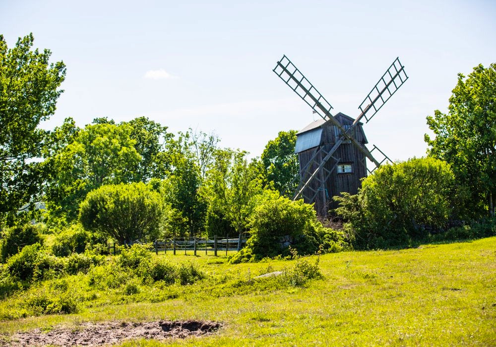
Thanks to its unique agricultural landscape, all of southern Öland has been designated a UNESCO World Heritage Site since 2000. Here, the island’s geographical location, the limestone-rich bedrock and the mild climate interact with generations of human effort – together shaping a landscape that is as distinctive as it is beautiful.
The hiking trail is one of STF’s signature trails, an exceptionally scenic and quality-assured multi-day hike.
Quick facts
Map of Signature trail Öland
Navigate past map or other external content.This map is a planning tool and should not replace a physical map and compass. The service “Naturkartan” (opens in new tab) is operated by a company called “Outdoor map”. Please note that trail information is owned and updated by the respective trail administrator (e.g. municipality or county administrative board).
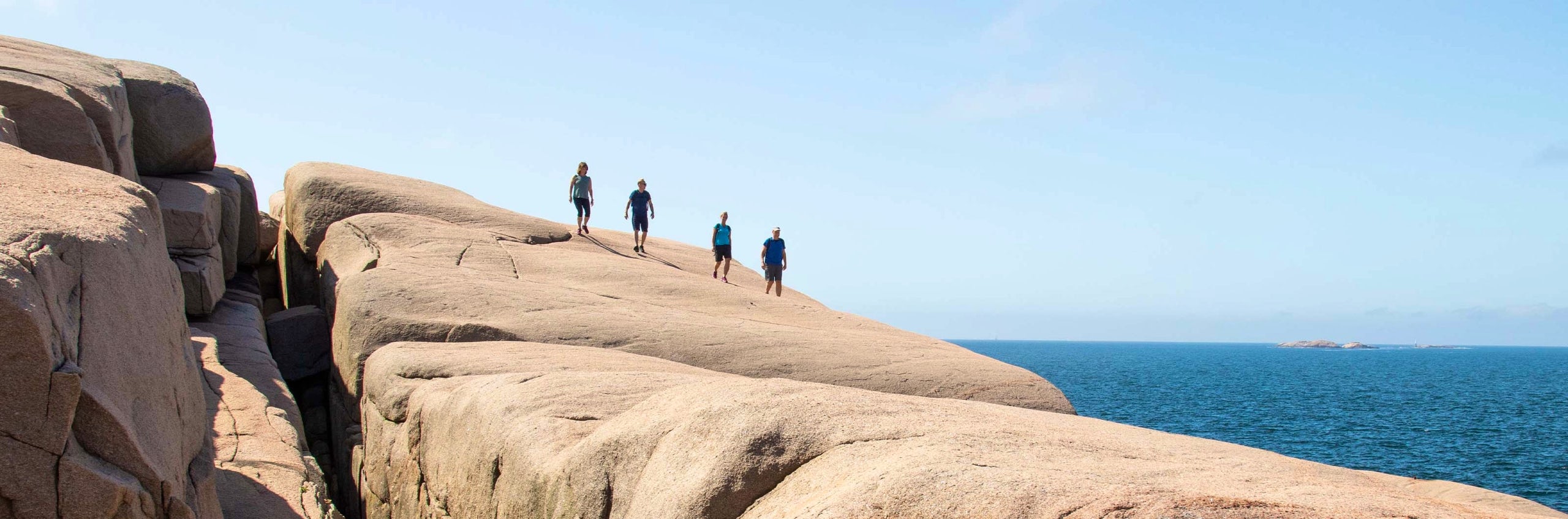
Discover Signature trail Öland (the Mörbylångaleden trail)
The soil on Öland begun being cultivated as early as in the Stone Age; then as well as now, arable and livestock farming have co-existed. Mörbylångaleden runs through this landscape of pastures, villages, wetlands and arable land.
The trail starts at the Öland Tourist Information Centre in Färjestaden and goes all the way down to the southern tip of Öland. It begins with inland hiking and, on day two, runs right by the eastern coast of Öland. On the third day, you traverse to the east side of Öland and the hike heads directly south on the following days. There is accommodation at the end of each stage. On the first and the last day you should make sure you bring food for dinner. There are restaurants available on the other days.
See and do along the trail
The hiking trail passes large parts of Öland and there are therefore a number of different activities along the way. Go swimming, rent kayaks, visit second-hand shops or galleries, for example. Öland has plenty of workshops for both design and crafts.
Don’t miss
The very southern tip of Öland has the famous lighthouse Långe Jan, as well as Ottenby Bird Station. There is a bird museum, public recreation areas, a nature visitor centre and a restaurant. There are also various types of guided bird tours on offer.
Transport to the trail
Train to Kalmar and then a bus with Kalmar Länstrafik (opens in new tab) to Färjestaden. Long-stay parking for those arriving by car is not available in Färjestaden. Transport back after the end of the walk is via Kalmar Länstrafik , but notice it´s sparse traffic.
Trail markers
The trail is marked with red wooden arrows. Information boards are also available in certain places and tell you more about the culture, nature and history of Öland.

Stages of Signature Trail Öland
Stage 1: Färjestaden-Skogsby
17 kilometres, 6–7 hours of hiking
Accommodation: STF Station Linné
The start of the trail is at Öland Tourist Information Centre, just next to the bridge. The whole section is an easy hike and it mainly runs on tarmac roads, gravel roads and tractor roads. At STF Station Linné (a research station with guided tours), continue on road 136 and walk north for one kilometre to reach the hostel. Limited availability of food and water along the section.
Stage 2: Skogsby-Mörbylånga
18 kilometres, 6-7 hours of hiking.
Accommodation: STF Bo Pensionat Vickleby
The second section begins on road 136, heading south, but quickly turns off onto smaller roads and then turns into footpaths and narrow tractor roads that run right along the coast. The hiking is easy and pleasant, sometimes through lush woodland and sometimes next to the sea. There are barbecue spots and toilets along the way. There are plenty of places to go for a swim! The trail runs just right past the hostel. Limited availability of food and water along the section, a fully licensed restaurant and self-catering facilities are available at the hostel.
Section 3: Mörbylånga-Kastlösa
13,5 kilometres, 4-5 hours of hiking.
Accommodation: Allégården Kastlösa (opens in new tab)
The trail continues along the coast until Mörbylånga. This is the last place along this hike where you can buy food. From here, the trail runs on gravel roads and tractor roads. At Klovenhälls Läge, approximately four kilometres from the end of the stage there is a nice rest stop by the sea. There is a restaurant at the end of the stage.
Section 4: Kastlösa-Gammalsby
22 km, 7–8 hours of hiking.
Accommodation: Gammalsbygården (opens in new tab)
The trail now runs from the west coast to the east coast. For large parts of the day, the hike takes you through the vast, barren Stora alvaret, occasionally with a view over the Baltic Sea. In the middle of the section, the trail runs in a straight line on an old railway embankment, which may sometimes be a bit uneven. In total, there are three official rest stops along the section. There is a toilet at the beginning and just before the end of the section. No food or water are available along the section. There is a restaurant at the end of the stage.
Stage 5: Gammalsby-Ottenby
12 km, 4–5 hours of hiking.
Accommodation: STF Ottenby Hostel
On the last day, the trail first continues along the old embankment, before heading through fields, paths and finally a country road. There is no available food or water along the section. There are self-catering facilities at the hostel.
Tip! Recharge or relax before or after your hike at STF Vickleby/Bo pensionat
More pages about hiking

All about hiking
On this page you will find helpful tips and information for your hike.

Hiking trails in Sweden
On this page we present a selection of popular and high-quality trails across the country.
Signature trails
STF has selected some of the most spectacular routes in the country and brought them together under the name Signature Trails.