Signature trail Österlen
Discover the Skåneleden stretch from Nybrostrand to Maglehem, which largely follows the coastline. We call it Signature Trail Österlen.
Skåneleden has seven sub-trails and more than 1,600 kilometres of hiking paths. The trails pass through varied landscapes with a rich cultural offering close at hand. Signature Trail Österlen is one of STF’s signature trails – a particularly scenic and quality-assured multi-day hike.
Quick facts
Map of Signature trail Österlen
Navigate past map or other external content.This map is a planning tool and should not replace a physical map and compass. The service “Naturkartan” (opens in new tab) is operated by a company called “Outdoor map”. Please note that trail information is owned and updated by the respective trail administrator (e.g. municipality or county administrative board).
Discover Signature trail Österlen
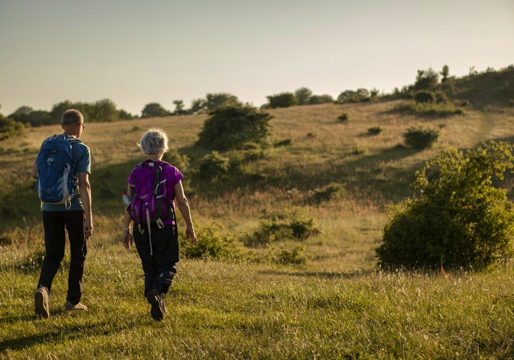
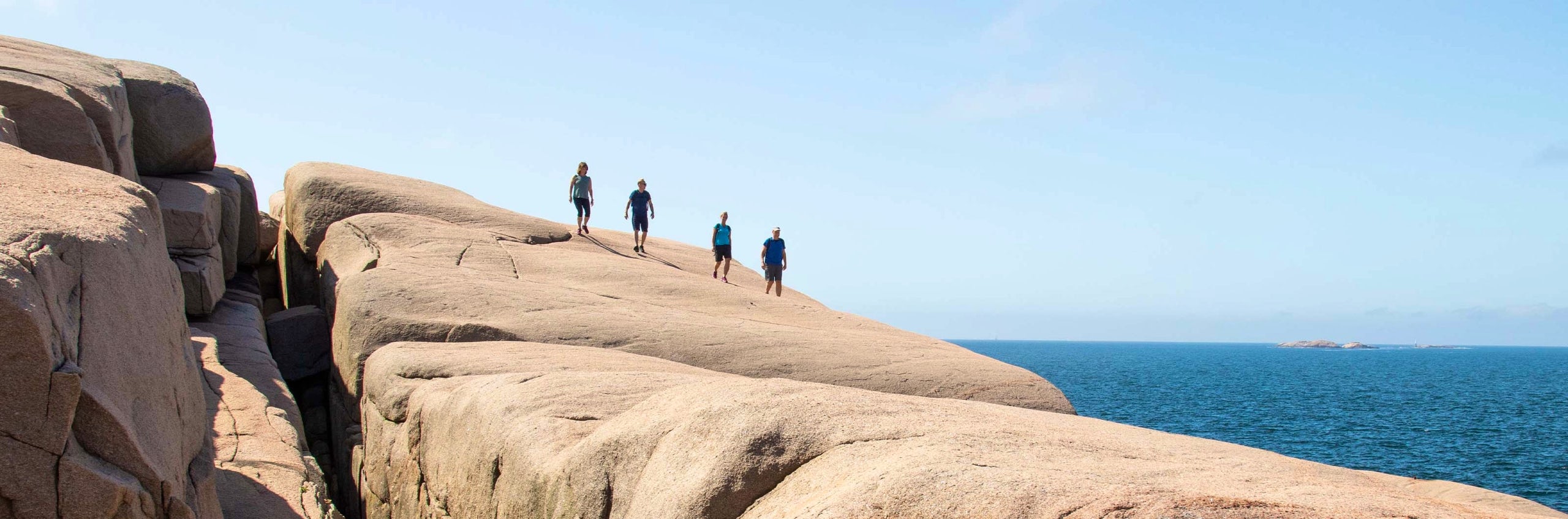
On a hike between Nybrostrand and Maglehem you get to experience both fascinating cultural history and magnificent nature, all at once. The trail runs across the Kåseberga ridge, which was formed by the inland ice some 15,000 years ago. On the ridge you will find Sweden’s largest ship setting, Ales Stenar – a beautiful, myth-shrouded and captivating site.
Along the way, open landscapes alternate with dense broadleaf forest. The terrain ranges from flat to rolling and sometimes steep. You walk across pink-shimmering heather moors, white beaches and sloping rock slabs, with a welcome sea breeze as your near-constant companion. The trail passes the vast sand dunes of Sandhammaren and Stenshuvud National Park with its dramatic views over Hanö Bay. It also leads you through nature reserves such as Drakamöllan and past characteristic coastal villages like Kivik, Baskemölla and Skillinge.

See and do along the trail
The range of galleries is extensive as Österlen has long attracted artists of all kinds. There are also many apple orchards offering sales of both apples and apple products.
Don’t miss
Bring swimwear! The hiking trail passes by and through several beautiful beaches.
Transport to the trail
The starting point is Nybrostrand, 10 kilometres east of Ystad. Both trains and buses run to Ystad. From Ystad, take a bus with Skånetrafiken to Nybrostrand. If travelling by car, there are multi-storey car parks and long-term parking in Ystad.
For the return journey to Ystad after completing the hike, the bus is recommended, which takes approximately one to two hours depending on the time of day. The trail ends in Maglehem, where you can catch a bus towards Kristianstad or Ystad for onward connections.
Trail Markers
The trail is marked with orange paint. Markings are usually painted on trees or posts. Sometimes, there is an orange ribbon.

Stages the Signature trail Österlen
Stage 1: Nybrostrand–Backåkra
17 km, 6-8 hours of hiking
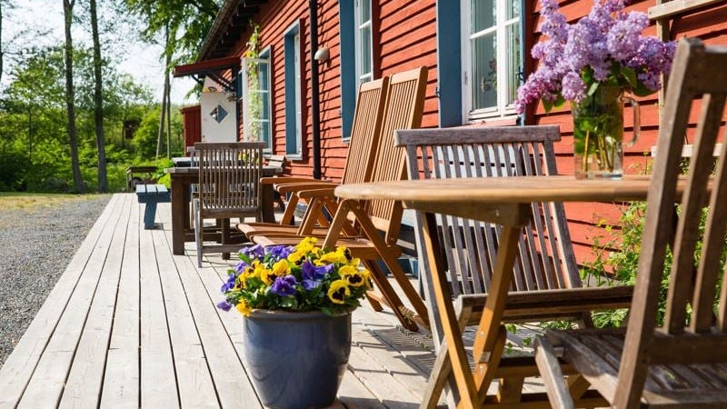
Accommodation: STF Backåkra Hostel
The stretch begins in the village of Nybrostrand, just outside Ystad, and follows a sandy waterfront promenade to start with. You then turn northward and walk along the road Östra Kustvägen on tarmac to Hammar. From here the trail follows the coastline again. After ten kilometres you reach Sweden’s largest ship setting, Ales Stenar. Here, in charming Kåseberga, you can top up on water and food – there is a café and restaurant. Continue past Löderups strandbad on the Skåneleden and turn off at the signs for Dag Hammarskjöld’s Backåkra. Head straight north past the museum and across the heathlands to STF Backåkra Hostel, which has a self-catering kitchen and serves breakfast during peak season.
Stage 2: Backåkra–Borrby Beach
11 km, 3-4 hours of hiking
Accommodation: Borrbystrand Camping (opens in new tab)
From the hostel, take Bjeringsborgsvägen south and rejoin the Skåneleden. From here the trail first crosses heather moors and passes through oak woodland. Then come the sand dunes of Sandhammaren, which can be challenging to walk on. At Sandhammaren there is food or water available. The rest of the stretch continues along sand dunes right by the sea, with no food or water available. At the stage destination, Borrbystrand Camping, there is a small grocery shop.
Stage 3: Borrby Beach–Brantevik
13 km, 4-5 hours of hiking
Accommodation: STF Brantevik Råkulle Hostel or STF Sköllengården Hotel
The stage follows coastal roads and cycle paths past the communities of Örnahusen, Norrekås and Skillinge. A detour to the picturesque fishing hamlet of Gislövshammar is recommended. This limestone headland is one of Österlen’s hidden gems, where you can see the remains of quarried millstones. Grazed shore meadows and open grass heaths are passed along the way. Brantevik, the end of the stage, is a charming fishing village. Brantevik Råkulle Hostel is in the village itself, and Sköllengården Country Hotel sits just above, with views over the village. A grocery shop and café can be found in Skillinge, roughly midway along the stretch.
Stage 4: Brantevik–Baskemölla
13 km, 4-5 hours of hiking
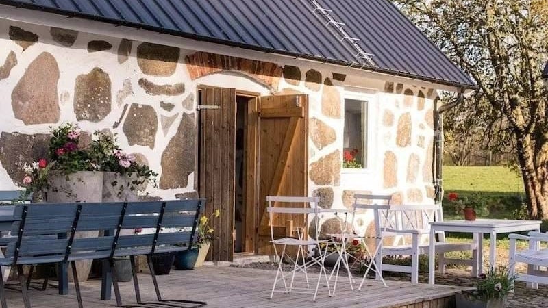
Accommodation: STF Baskemölla Hostel
The stretch between Brantevik and Simrishamn runs right along the coast, across sandy beaches and boulder-strewn meadows. Once you reach the village of Baskemölla, take Tjörnedalavägen north for just under a kilometre to reach the hostel. When passing through Simrishamn it is a good opportunity to eat and top up on water.
Stage 5: Baskemölla–Kivik
16 km, 5-6 hours of hiking
Accommodation: STF Kivikstrand seaside hotel
Head back the same way you finished yesterday to rejoin the Österlen trail. From here the trail follows the coast to the old fishing village of Vik. North of Vik you enter the highlight of the stretch – Stenshuvud National Park, where a climb to the summit of the mountain of the same name awaits. The final part of the stretch into Kivik follows the road. STF Kivikstrand Beach Hotel is right in the centre of the village. Cafés, summer-season restaurants and Kiviks Musteri are passed along the way.
Stage 6: Kivik–Haväng
5 km, 1-2 hours of hiking
Accommodation: STF Skepparsgården Haväng, STF Farmors Lycka Gårdshotell Österlen
You continue your hike northward, with the trail following Hanö Bay the entire stretch. Since this is a short day stage, there is time for sunbathing and swimming if the weather allows. After leaving STF Kivikstrand Beach Hotel, follow the beach and walk through the Vitemölla rambling area. Here you cross sand steppe, a rare habitat type. At the end of the day stage the trail turns inland. After 300 metres you reach STF Haväng Hostel, an authentic half-timbered farmstead dating back to the 1800s. You can also continue a little further to Farmors Lycka Hotel. Before reaching Haväng you pass a Stone Age burial monument, Havängsdösen. No food or water is available after leaving Kivik. The stretch is easy.
Stage 7: Haväng–Maglehem
15,3 km, 5-6 hours of hiking
Accommodation: Maglehems Musteri (opens in new tab) or Solgården Maglehem (opens in new tab)
On the final day the trail leaves the sea and heads west inland. First you walk among grazing livestock across the beautiful heaths of Ravlunda. Stop at Farmors Lycka Hotel for a coffee or lunch if you have not already stayed there.
After crossing road 19, the trail winds up and down Österlen’s famously rolling hills – Brösarp’s backar – in the Verkeån Nature Reserve. This enchanting landscape, shaped by the Ice Age, has served as the setting for both the film The Brothers Lionheart and Arla’s Bregott Factory advertising campaign. In Brösarp you turn north and walk towards Maglehem. On the final long stretch you pass Kumlan and Drakamöllan nature reserves, where former arable farmland has been transformed into sweeping grass heaths with sand steppe and species-rich pastures. Here the landscape rolls gently between open heaths and majestic beech forests, and with a little luck you may catch a glimpse of the exotic black-and-yellow golden oriole – a bird more often heard than seen.
In Maglehem there are options for accommodation and dining, and buses run from here to Ystad or Kristianstad.
More information about each section can be found on Skaneleden.se (opens in new tab).
STF-accommodation close to the trail


STF Lövestad Lilla Rygården Bed and Breakfast


More pages about hiking

All about hiking
On this page you will find helpful tips and information for your hike.

Hiking trails in Sweden
On this page we present a selection of popular and high-quality trails across the country.
Signature trails
STF has selected some of the most spectacular routes in the country and brought them together under the name Signature Trails.