Signature trail Siljan
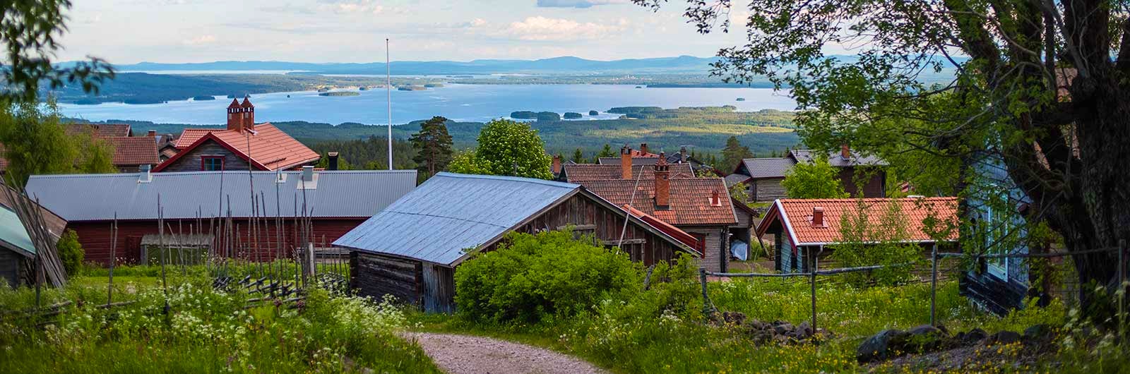
The Signature Trail Siljan runs from Fryksås to Rättvik and is lined with classic Dalarna scenery - summer farms, red cottages and pastoral landscapes. It forms a small part of the 340 km Siljan Trail, which circles Lake Siljan and Lake Orsasjön in Dalarna.
This hiking route is one of STF’s Signature Trails – a particularly scenic and quality-assured multi-day hike.
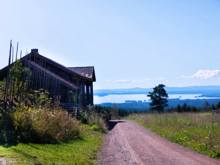
Fryksås summer farms sit high above Orsasjön, offering stunning views, and are the largest preserved collection of summer farm buildings in Sweden. From here, you begin a beautiful descent to Orsa, where you spend the first night. The following days follow the Dalkarlsvägen (the same route as the Siljan Trail towards Rättvik).
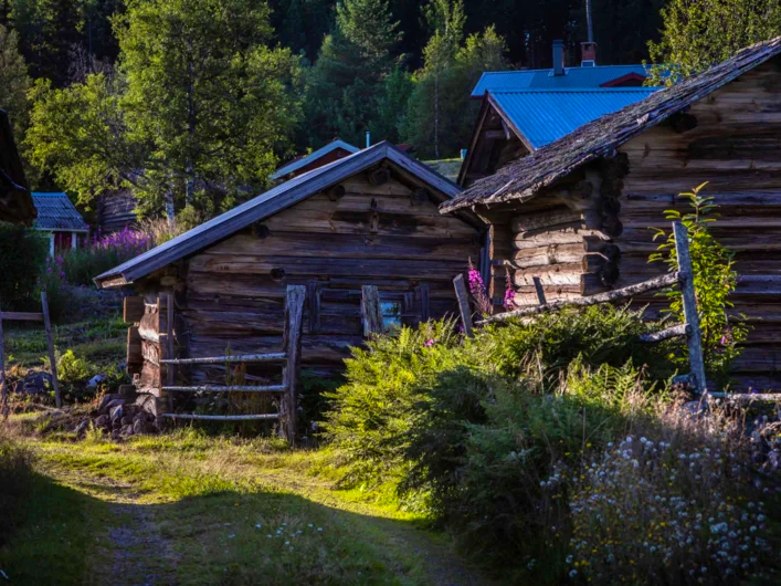
In the 16th century, people from Dalarna walked this route on so-called “labour journeys” to Stockholm, seeking work from wealthy employers. This history is present throughout the hike. On the second night, you camp at the Brunnvasselbodarna summer farm, which dates back to the 17th century. Between Granmor and Nittsjö, the trail follows the historic Kyrkvägen – a medieval route of cultural significance. On the final day, you pass Rättvik Church, dating from the 13th century and well worth a visit.
Quick facts
Map of Signature trail Siljan
Navigate past map or other external content.This map is a planning tool and should not replace a physical map and compass. The service “Naturkartan” (opens in new tab) is operated by a company called “Outdoor map”. Please note that trail information is owned and updated by the respective trail administrator (e.g. municipality or county administrative board).
See and do along the trail
At the museum Rättviks naturmuseum, you can learn more about the geology of the area around Siljan, and at Siljansfors Skogsmuseum, you can learn everything about Swedish forestry.
Don’t miss
Siljansleden also has a very beautiful section for bicycles, marked with blue markers. It is 310 kilometres long.
Transport to the trail
Trains go to Mora, then a bus to Fryksås with Dalatrafik. Book train tickets via SJ (new window) and your bus tickets via Dalatrafik.se (opens in new tab). Cars can be parked in a long-stay car park in Mora, take a bus to Fryksås and also a bus back at the end of the hike.
Trail markers
Signs and orange markings around tree trunks and wooden poles.
Sections of Signature trail Siljan
Section 1: Fryksås-Orsa
17,7 kilometres, 7–8 hours of hiking
Accommodation: STF Orsa Hostel
This section starts at Fryksås Fäbodar, which is situated at a high point with a view over the lake Orsasjön. The hike is on footpaths with both uphill and downhill sections through lush woodland. The section ends in the middle of Orsa. There is no water or food available along this stage. STF Orsa Hostel is in the middle of town, by the indoor skating rink.
Section 2: Orsa Church-Brunnvasselbodarna
13,9 kilometres, 6–7 hours of hiking
Accommodation: Pitch your tent at the Brunnsvallsbodarna summer pasture.
From day two, the hike follows Dalkarlsvägen, which takes the same route as the Siljansleden to Rättvik. Between Orsa and Viborg, the trail goes through towns and villages. After Viborg, it continues through varied surroundings such as forests, farmland and built-up areas. You are on footpaths for most of the time, but there are also minor roads and gravel roads. Water can be taken from streams along the trail, but no food is available. At the end of the stage you can take water from the stream Brunnvasselån.
Section 3: Brunnvasselbodarna-Tammeråsen
10 kilometres, 3–4 hours of hiking
Accommodation: Pitch your tent at Tammeråsen.
After Brunnsvallsbodadarna, the trail splits and Dalkarlsvägen and Siljansleden run parallel to one another for two kilometres, after which they join up again. Tammeråsen is located high up in a secluded, south-facing spot. Be sure to fill up with water when you pass the stream Ickån as there is no access to water at the end of the stage. Limited access to water along the trail, no food available.
Section 4: Tammeråsen-Rättvik
18,3 kilometres, 7–8 hours of hiking
The trail continues on footpaths through a varied landscape. After five kilometres you reach the village of Röjeråsen, in the summer months it is possible to fill up with water here. On your way to Rättvik, you pass Rättvik Church from the 13th century. No food is available on this section. There are shops and restaurants at the end of stage in Rättvik.
Accommodation nearby


More pages about hiking

All about hiking
On this page you will find helpful tips and information for your hike.

Hiking trails in Sweden
On this page we present a selection of popular and high-quality trails across the country.
Signature trails
STF has selected some of the most spectacular routes in the country and brought them together under the name Signature Trails.