Storulvån – Ljungdalen
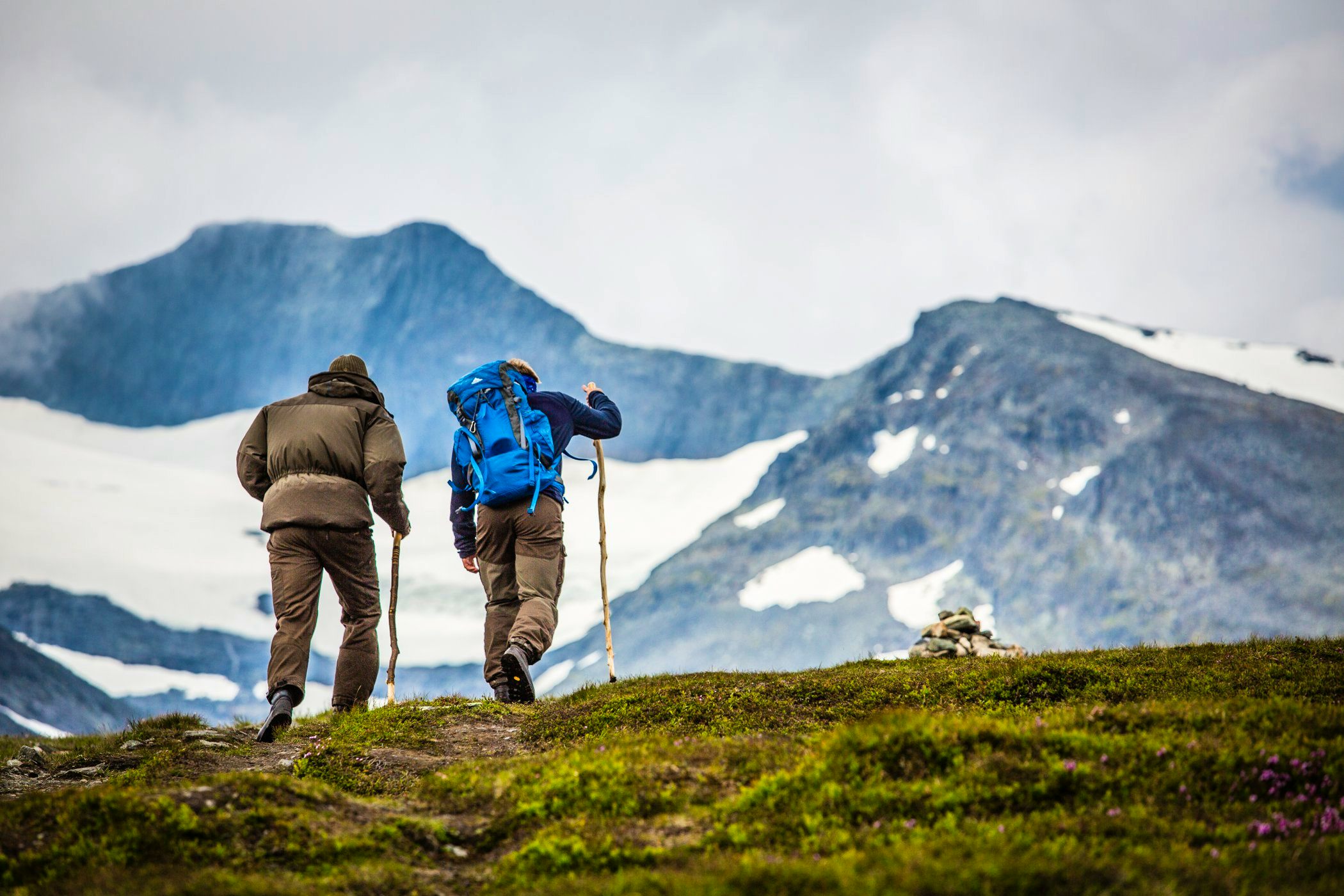
This tour runs from Storulvån in the north to Ljungdalen in the south. It's a classic hike that, over three days, crosses vast mountain plateaus and majestic mountain ranges. At each trail section destination, there is a mountain station with a shop, accommodation, shower, sauna, and a restaurant offering both breakfast and dinner.
Quick facts
Discover Storulvån – Ljungdalen
The trail between Storulvån and Ljungdalen is a classic three-day hike ranging from 12 to 19 kilometers each day. You have the opportunity for shelter every night along the way. The purpose of building overnight accommodations in the mountains in the late 1800s was quite different from hiking from place to place “for the sake of hiking”. It was Syltoppen that was the goal, not the hike itself. STF’s very first mountain hut project in Jämtland was to build a simple cabin near Sylarna in 1890. It was placed between Enkälen and Sylmassivet, north of Enan. You pass by the signposted location on your way to Sylarna Mountain Station.
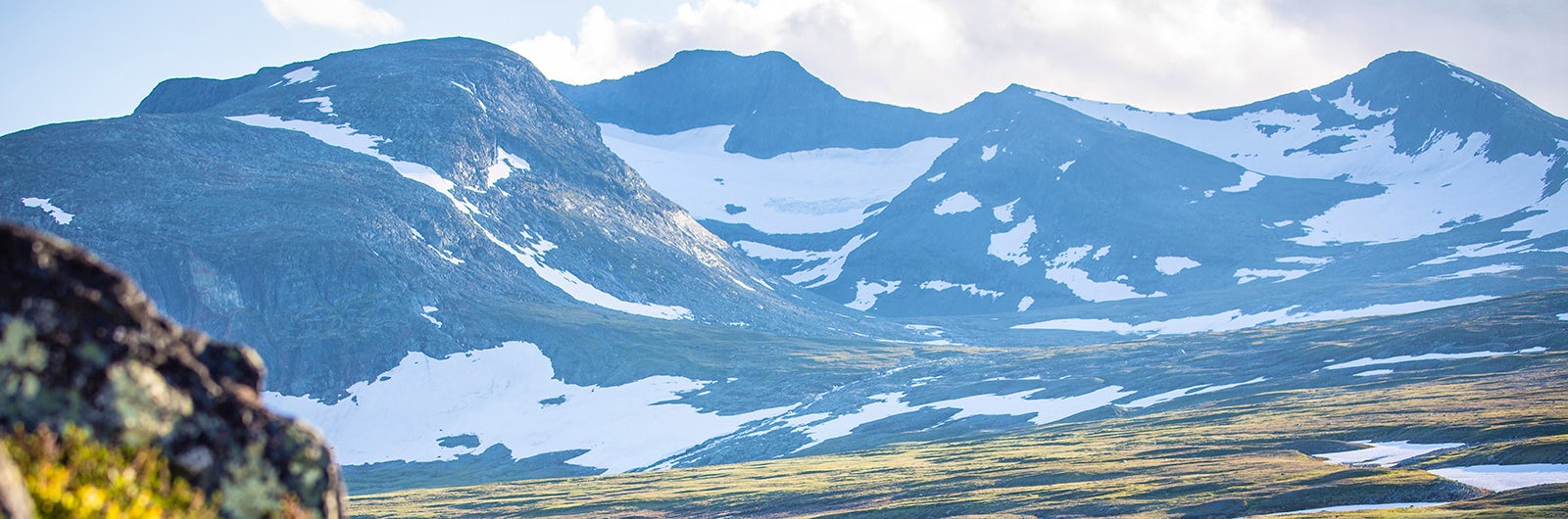
Except for a few kilometers at the very beginning and end of the hike, this route traverses alpine terrain far above the tree line. On clear days, you are treated to expansive mountain views. The wetlands along the route are usually bridged, and bridges take you over the watercourses.
Learn more about how to avoid disturbing the reindeer.
See and do along the trail
Climb the peaks Storsylen or Helags, both possible even for those less experienced. Guided tours are available for booking at the mountain stations.
Directions
Buy your train tickets with SJ (opens in new tab) to Duved/Enafors and then continue with Wänseth bus (opens in new tab) to Storulvån. Transfer to/from the night train can be booked directly with them or by phone at 0647-704 77.
Another convenient option is to travel with Snälltåget (opens in new tab), which operates trains to Enafors twice a week during parts of the winter and summer seasons. Through Snälltåget, you can book both the train journey and the connecting bus or transfer all the way to the mountain station. During parts of the winter and summer seasons, you can also travel from Ljungdalen with Snälltåget’s transfer bus to Röjan or Östersund.
From Ljungdalen, the easiest way is to take bus to Östersund with Länstrafiken Jämtland (opens in new tab). From there, you can take either a train or a bus to Mora, via Åsarna.
Please note that there’s about 8 km between Kläppen (where the trail ends) and Ljungdalen. It’s possible to walk, but you’ll have to walk along the road. Taxi Ljungdalsfjällen (opens in new tab) offers transfers to the village.
Sections of Storulvån – Ljungdalen
Below are descriptions of different accommodations, stages with distances, and other relevant hiking information.
Of course, it is possible to hike in the opposite direction to how the trail sections are presented.
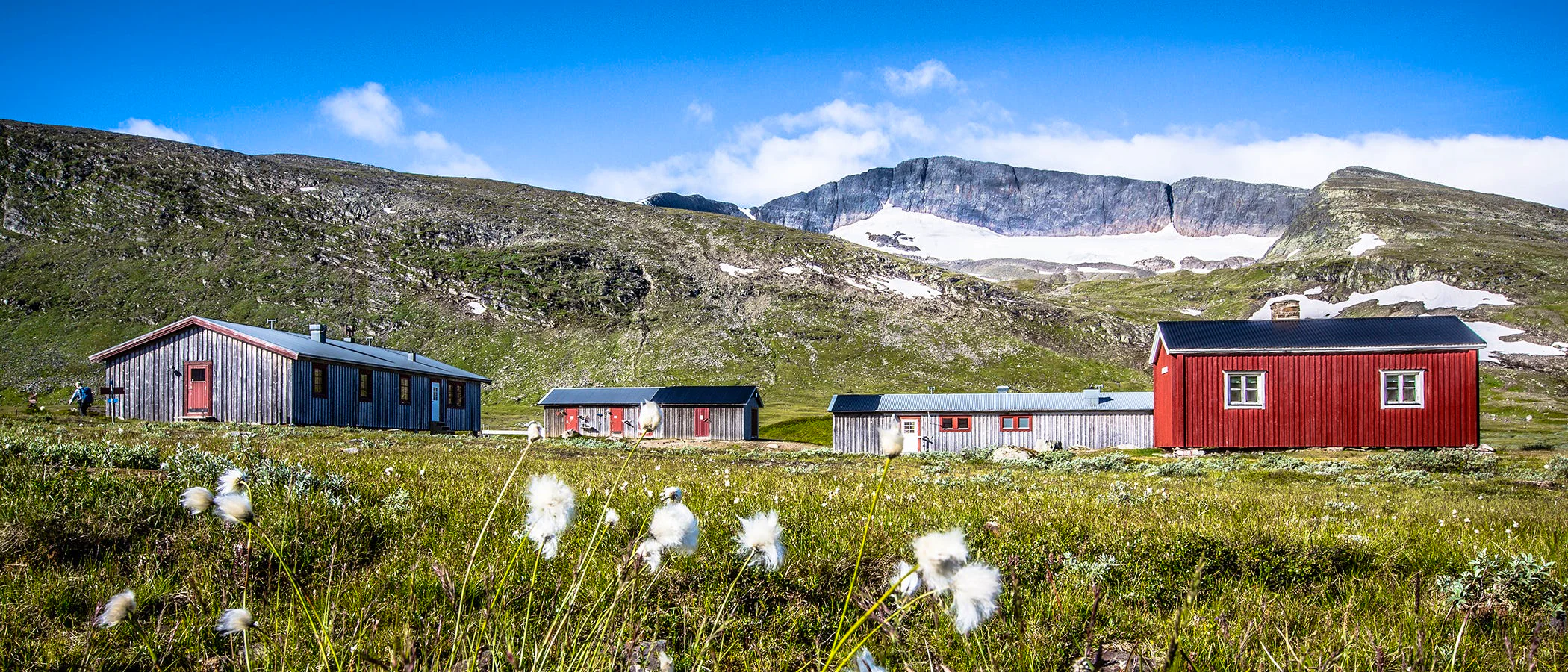
Section 1: STF Storulvån Mountain Station – STF Sylarna Mountain Station
16 kilometers, 5–6 hours of hiking
Accommodation: STF Sylarna Mountain Station
After a few kilometers of hiking, you leave the mountain birch forest around Storulvån Mountain Station and reach the alpine terrain. You soon pass the suspension bridge over the river Lill-Ulvån. The trail then continues through rolling terrain towards the shelter Spåime, located about halfway to Sylarna Mountain Station. Here, the trail mainly goes through dry sections, but there are also boardwalks over marshy areas. During the hike, your gaze will constantly be drawn to the horizon and the pointed peaks of Sylarna.
The trail continues in similar terrain towards the shelter Gamla Sylen, which you reach before the final 3 kilometers of ascent to the mountain station.
The terrain during the hike is gently undulating and without any major difficulties. Bridges and boardwalks make it easy to cross streams and wet areas.
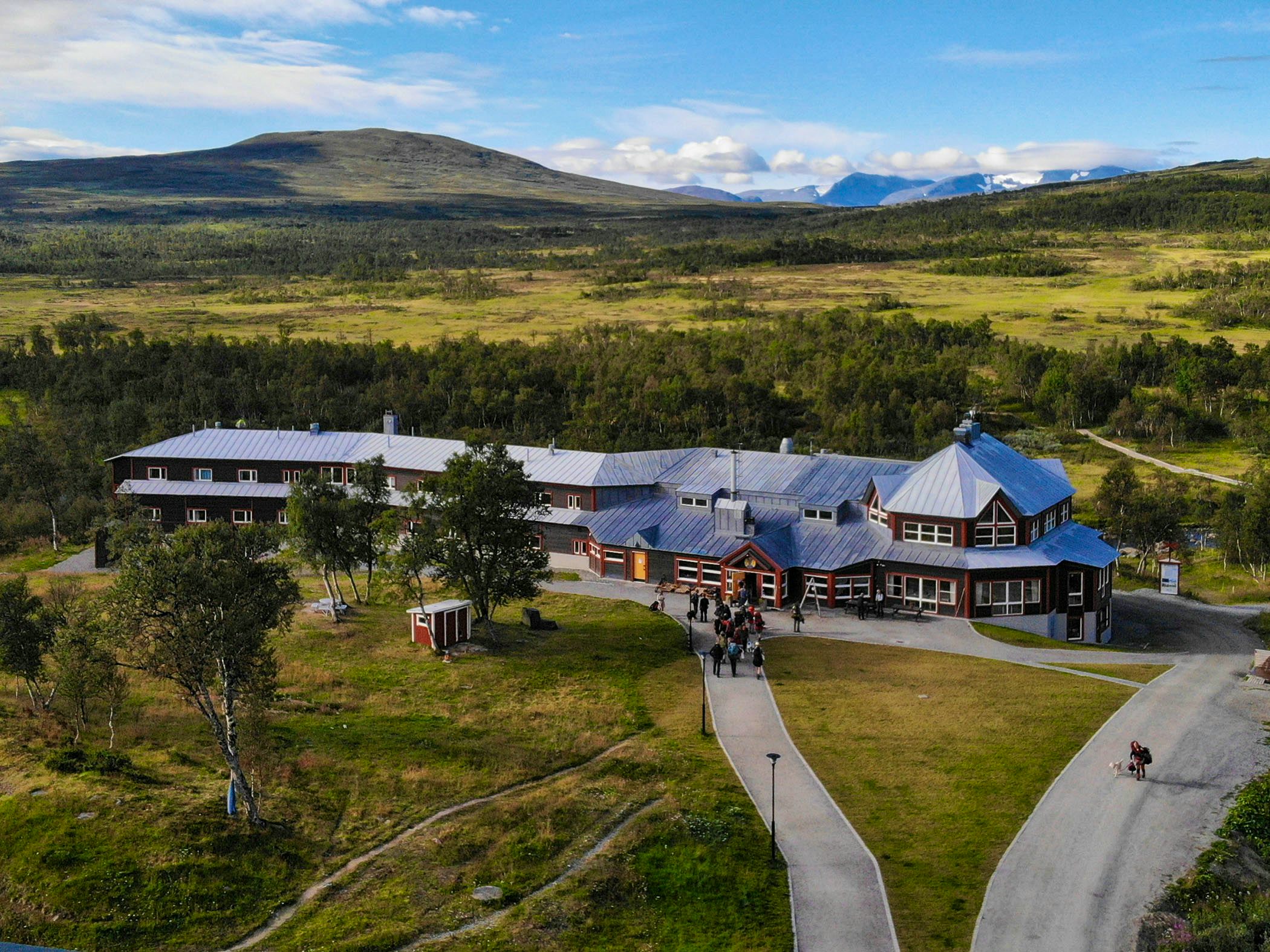
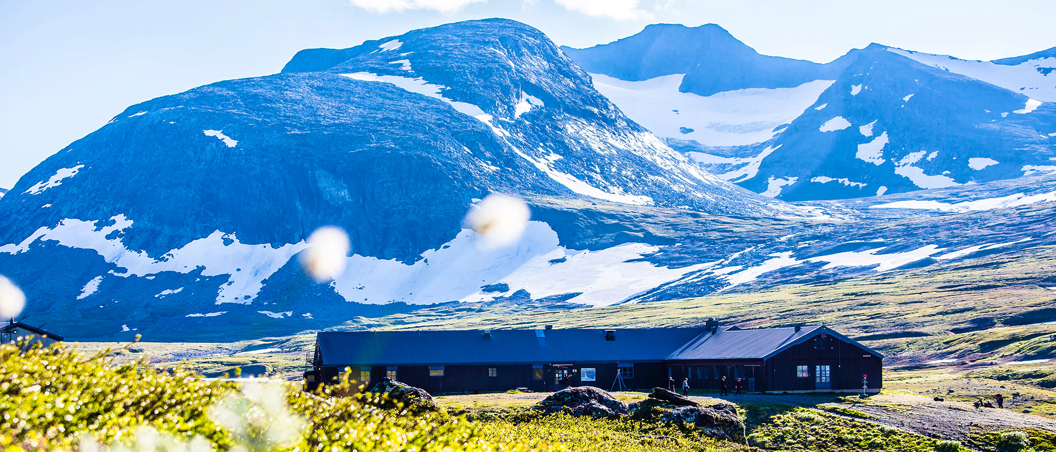
Section 2: STF Sylarna Mountain Station – STF Helags Mountain Station
19 kilometers, 6–7 hours of hiking
Accommodation: STF Helags Mountain Station
Your hiking day starts along the Sylälven River, which gracefully winds its way through the mountain landscape below the mighty Syl massif. The trail may be perceived as rocky until the intersection. An alternative starting point from STF Sylarna Mountain Station is the summer trail east of Herrklumpen. This trail starts steeper from Sylarna and is slightly shorter. Here, you gain more elevation and get a beautiful view of Sylmassivet.
After a couple of kilometers, the trail turns towards a trail junction, where you will have two options. Choose the slightly shorter route, signposted “Helags,” and walk through the pass between Kläppen and Herrklumpen towards Mieskentjakkes shelter.
The final stretch follows a lovely path along Handölan, with no significant elevation gain. STF Helags Mountain Station awaits at the foot of Sweden’s highest peak south of the Arctic Circle.
Section 3: STF Helags Mountain Station – Kläppen/Ljungdalen
12 kilometers, 3–4 hours of hiking
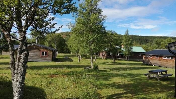
Accommodation: STF Fjällhornet Resort Ljungdalen, STF Ljungdalen Hostel
You hike on a well-trodden path in an outstanding mountain environment with the Helags massif behind you. The first half of the hike is on dry heathland before the terrain gradually transitions to mountain birch forest. Around Lake Kesusjön, west of Ljungdalen, many sports cabins and a beautiful mountain pasture stand.
End with a night at Fjällhornet or walk 6 kilometers by road from Kläppen to Ljungdalen where a hostel awaits. There are taxis in the area.
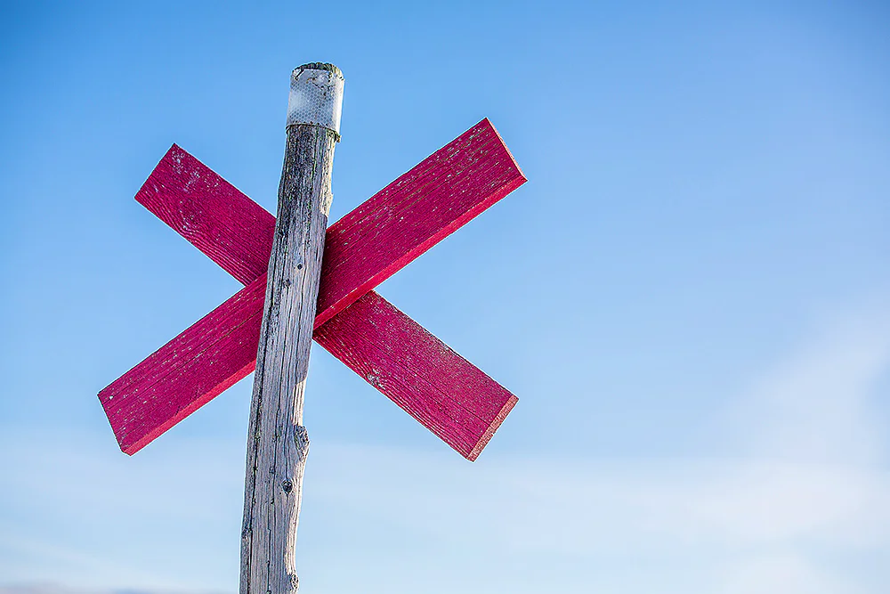
Trail markings
Check the trail markings before you set out. Winter trails are marked with crosses, while summer trails are marked with painted poles, stones, or trees. Winter trails can be difficult to follow in summer, so use a map and trail signs to navigate.
Read more about the trail systemAccommodation nearby
STF Helags Mountain station
STF Storulvån Mountain station
STF Sylarna Mountain station
Visitor calendar
Do you prefer a quieter experience in the mountains? Our visitor calendar gives you an overview of typical occupancy levels in this mountain area, helping you plan your trip during less busy periods. During quieter times, we also often offer better prices. Please note that the visitor calendar is only an indication and does not account for variations due to events or holidays.
Week |
24 |
25 |
26 |
27 |
28 |
29 |
30 |
31 |
32 |
33 |
34 |
35 |
36 |
37 |
38 |
39 |
40 |
|---|---|---|---|---|---|---|---|---|---|---|---|---|---|---|---|---|---|
Storulvån |
Closed |
More visitors Thurs-Sat |
Few visitors |
Few visitors |
Most visitors |
Most visitors |
Most visitors |
Most visitors |
Most visitors |
Most visitors |
More visitors Thurs-Sat |
More visitors Thurs-Sat |
More visitors Thurs-Sat |
More visitors Thurs-Sat |
More visitors Thurs-Sat |
Few visitors |
Few visitors |
Sylarna |
Closed |
Closed |
Closed |
Closed |
Closed |
Most visitors |
Most visitors |
Most visitors |
Most visitors |
Most visitors |
More visitors Thurs-Sat |
More visitors Thurs-Sat |
More visitors Thurs-Sat |
More visitors Thurs-Sat |
More visitors Thurs-Sat |
Few visitors |
Closed |
Blåhammaren |
Closed |
Closed |
Closed |
Few visitors |
Most visitors |
Most visitors |
Most visitors |
Most visitors |
Most visitors |
Most visitors |
More visitors Thurs-Sat |
More visitors Thurs-Sat |
More visitors Thurs-Sat |
More visitors Thurs-Sat |
More visitors Thurs-Sat |
Few visitors |
Closed |
Helags |
Closed |
Closed |
Closed |
Few visitors |
Most visitors |
Most visitors |
Most visitors |
Most visitors |
Most visitors |
Most visitors |
More visitors Thurs-Sat |
More visitors Thurs-Sat |
More visitors Thurs-Sat |
More visitors Thurs-Sat |
More visitors Thurs-Sat |
Few visitors |
Closed |
Vålådalen |
Few visitors |
Few visitors |
Few visitors |
Few visitors |
More visitors |
More visitors |
More visitors |
More visitors |
More visitors |
More visitors |
Few visitors |
Few visitors |
Few visitors |
Few visitors |
Few visitors |
Closed |
Closed |
Tänndalen / Skarvruet |
Few visitors |
Few visitors |
Few visitors |
Few visitors |
More visitors |
More visitors |
More visitors |
More visitors |
More visitors |
More visitors |
Few visitors |
Few visitors |
Few visitors |
Few visitors |
Few visitors |
Closed |
Closed |
Lunndörren |
Closed |
Closed |
Closed |
Few visitors |
Most visitors |
Most visitors |
Most visitors |
Most visitors |
More visitors Thurs-Sat |
More visitors Thurs-Sat |
More visitors Thurs-Sat |
More visitors Thurs-Sat |
More visitors Thurs-Sat |
More visitors Thurs-Sat |
More visitors Thurs-Sat |
Closed |
Closed |
Stensdalen |
Closed |
Closed |
Closed |
Few visitors |
Most visitors |
Most visitors |
Most visitors |
Most visitors |
More visitors Thurs-Sat |
More visitors Thurs-Sat |
More visitors Thurs-Sat |
More visitors Thurs-Sat |
More visitors Thurs-Sat |
More visitors Thurs-Sat |
More visitors Thurs-Sat |
Closed |
Closed |
Vålåstugan |
Closed |
Closed |
Closed |
Few visitors |
Most visitors |
Most visitors |
Most visitors |
Most visitors |
More visitors Thurs-Sat |
More visitors Thurs-Sat |
More visitors Thurs-Sat |
More visitors Thurs-Sat |
More visitors Thurs-Sat |
More visitors Thurs-Sat |
More visitors Thurs-Sat |
Closed |
Closed |
Fältjägaren |
Closed |
Closed |
Closed |
Few visitors |
More visitors |
More visitors |
More visitors |
More visitors |
Few visitors |
Few visitors |
Few visitors |
Few visitors |
Few visitors |
Few visitors |
Few visitors |
Closed |
Closed |
Arådalen |
Closed |
Few visitors |
Few visitors |
Few visitors |
Few visitors |
Few visitors |
Few visitors |
Few visitors |
Few visitors |
Few visitors |
Few visitors |
Few visitors |
Few visitors |
Few visitors |
Few visitors |
Closed |
Closed |
Anaris |
Closed |
Closed |
Closed |
Few visitors |
More visitors |
More visitors |
Most visitors |
Most visitors |
More visitors Thurs-Sat |
More visitors Thurs-Sat |
More visitors Thurs-Sat |
More visitors Thurs-Sat |
More visitors Thurs-Sat |
More visitors Thurs-Sat |
Few visitors |
Closed |
Closed |
More pages about the mountains

Mountain guide
Find important information about mountain safety, waste management, and what it’s like to stay in a mountain cabin.

Mountain safety
Learn how to prevent injuries, use a map and compass, and safely cross streams during your hike.

Mountain hiking
Discover hiking in the Swedish mountains, from day hikes to multi-day adventures.