Signature trail Bergslagen
Signature trail Bergslagen is a section of the 280 km long Bergslagsleden trail and takes you from Lekhyttan to the wooden town of Nora.
The Bergslagsleden trail runs through the entire Örebro County, through beautiful Bergslagen nature with vast forests, lakes and several viewpoints. Signature trail Bergslagen is a section and one of STF’s signature trails – a particularly scenic and quality-assured multi-day hike.
Quick facts
Map of Signature trail Bergslagen
Navigate past map or other external content.This map is a planning tool and should not replace a physical map and compass. The service “Naturkartan” (opens in new tab) is operated by a company called “Outdoor map”. Please note that trail information is owned and updated by the respective trail administrator (e.g. municipality or county administrative board).
Discover Signature trail Bergslagen
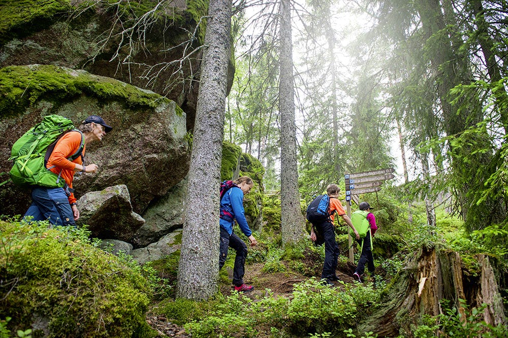
No other lowland trail in Sweden offers as many opportunities to experience vast forests, rare plants, wildlife, small forest tarns, lakes and untouched mires. The inland ice sheet has left many traces, including undisturbed eskers, fascinating caves, mysterious giant’s kettles, impressive boulder fields and scenic viewpoints.
The Bergslagsleden trail passes through Pershyttan cultural reserve, a well-preserved mining village where ore has been extracted and iron produced from the Middle Ages to modern times. Here you will find both a blast furnace and mines. Sweden’s only functioning water wheel with rod system is located in Pershyttan.
See and do along the trail
Join a mine tour in Pershyttan that takes you 45 meters underground in one of the early iron ore mines, Lockgruvan. Stay comfortably and enjoy good food in the wooden town of Nora. If you want to extend your hike, an extra day around one of the loop trails Göljestigen or Blankhult is recommended. The cave system in Skärmarbodabergen, located near Mogetorp, is also an exciting detour.
Find your way to the trail
Take a bus with Länstrafiken to Lekhyttan and return from the final stage in Nora. Train connections are available in Örebro.
Trail marking
The Bergslagsleden trail is marked with orange rings featuring a hiker symbol. Blue directional arrows are clearly placed along the trail.
Stages of the Bergslagen Signature trail
Stage 1: Lekhyttan–Suttarboda
16 kilometers, 4–6 hours of hiking
Accommodation: Shelter or tent at Suttarboda
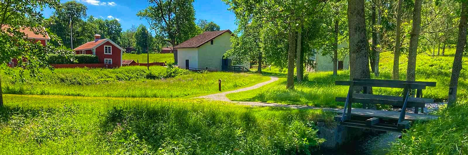
You start your hike in Lekhyttan, where Hallagården offers accommodation and Lekhyttans Kök restaurant. Here you can fill your coffee thermos before setting off.
After a short stretch on an asphalt road, the trail leads uphill onto a path towards Tväggelåten, where there is a rest area with a wind shelter, fireplace and dry toilet. There is also a small bathing ladder in the tarn if you want to cool off. The stage then continues through Dunderklintarna nature reserve, where you will find an architect-designed wind shelter by Lake Stora Murstenstjärn, suitable for an overnight stay. The trail continues towards Garphyttan National Park, one of the oldest in the country. Enjoy the old farmland with its abundance of meadow flowers, fascinating plants and wildlife. The trail then winds uphill through lush forest, and once you reach Svenshytteberget, you’ve earned a short break. From here, about 1.5 kilometres remain to the rest area in Suttarboda, which offers a wind shelter, fireplace, dry toilet and open spaces for those who wish to camp. Drinking water is available at the barn approximately 300 meters north of the rest area.
Stage 2: Suttarboda–Blankhult
17 kilometers, 4–6 hours of hiking
Accommodation: Wind shelter or tent, as well as Blankhults gård (opens in new tab), a bookable overnight cabin.
The first 7 km of the day takes you to Ånnaboda. Take a moment on Falkaberget for beautiful views and wise words from Dag Hammarskjöld along the way. Ånnaboda offers accommodations, meals, swimming, and a glass shelter at the Ånnaboda Lake bathing area. You then continue through four nature reserves. You’ll pass Göljan’s rest area with a shelter, fire pit, and toilet. Here, you can explore Göljestigen, a loop trail with boulder fields and waterfalls. Continuing your hike, you’ll pass Tomasboda. Although open only on winter Sundays, you can rest in the hiker’s chapel or shelter, and there is a well available. From here, it’s about 3 km to the Blankhult endpoint. Accommodation at Blankhults gård must be booked, but there’s also a shelter with a fire pit and space for tents. There is a water tap on the house’s gable.
Stage 3: Blankhult–Mogetorp
14 kilometers, 4–5 hours of hiking
Accommodation: Shelter, tent or rooms at Mogetorps Wärdshus (opens in new tab)
On this section, you will pass several boulder fields formed when the waves of the Yoldia Sea surged all the way from Russia and washed over the edge of Kilsbergen. As you emerge from the magnificent Trolldalen, a rift valley where the stream at times rushes or gently flows, you will find a loop trail called Blankhult. It leads you to Skrikarboda, where you can camp or rent the old cabin. The wind shelter that was previously located here burned down in 2025, and a new one is planned, though it is currently unclear when it will be completed.
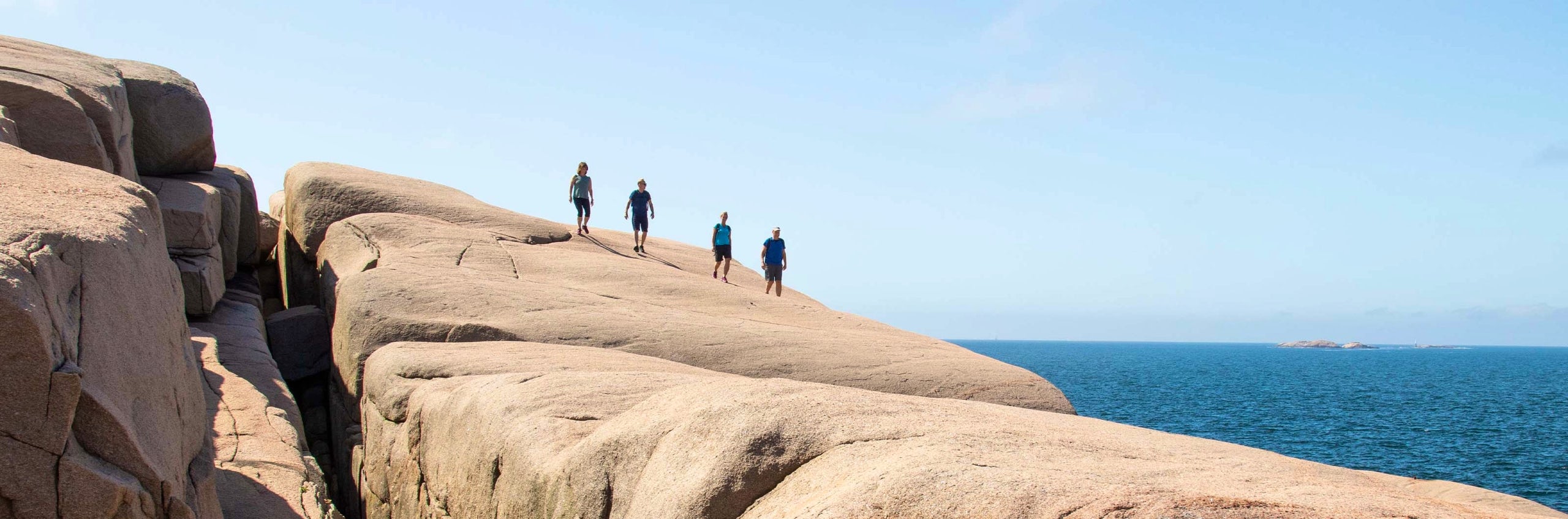
If you do not stay overnight in Skrikarboda and instead continue along the trail, it will take you up onto the Kilsbergen ridge past one of the finest viewpoints in the area, Rusakulan. Follow the marked path to the summit and take in views across the entire Närke region. See if you can count the 21 church towers visible from the top. After about 3 km, you will reach Amboberget, another loop trail with a beautiful viewpoint, which can also be used as a shortcut to reach stage 7 of the Bergslagsleden trail. Here, you can choose to stay overnight at Kvarndammens rastplats in Ramshyttan, with options for camping or a wind shelter, bringing you closer to Pershyttan for the next day.
If you instead continue towards the stage finish at Mogetorp, you will find fika, meals and accommodation in rooms at Mogetorps Wärdshus. Drinking water is also available outside the inn.
Tip: Take a detour into the Skärmarbodabergen nature reserve, where you will find a loop trail with cave areas, steep cliffs and ancient pine trees.
Stage 4: Mogetorp–Pershyttan/Nora
15 kilometers, 4–5 hours of hiking, about 2.5 km extra to Nora
Accommodation: Hotel, hostel, wind shelter
Starting in Mogetorp, you hike towards Pershyttan, passing south of the Skärmarbodabergen nature reserve, which holds impressive traces from the Ice Age. You then pass through Ramshyttan, an area marked by its history of iron production, where you will find a couple of B&B options.
The trail then follows a dug canal west towards Lake Dammsjön in the Kvarnbäcken-Lerkesån nature reserve. At Lake Dammsjön, there is an opportunity for a swim before you reach the mining village of Pershyttan. Here, the trail passes through the village’s historic buildings, and when you have the restored rod system on your right, you are almost at the train carriages, which offer food service during summer.
From here, you can follow the road and a cycle path to central Nora, an additional approx. 2.5 km, where a wider range of services is available.
Tip: Book a guided tour in the Pershyttan cultural reserve. Lockgruvan and other sights await during the tour.
More pages about hiking

All about hiking
On this page you will find helpful tips and information for your hike.

Hiking trails in Sweden
On this page we present a selection of popular and high-quality trails across the country.
Signature trails
STF has selected some of the most spectacular routes in the country and brought them together under the name Signature Trails.