Signature trail southern Tjustleden
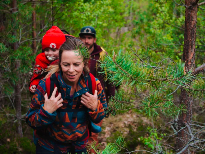
Tjustleden winds through the varied landscape of Västervik municipality, where the sense of wilderness is never far away.
The trail offers a unique combination of forest, lakes and cultural heritage. Here you hike through quiet forests, along glistening lakeshores and past ancient remains that bear witness to a long history in the landscape. Tjustleden is approximately 200 kilometres in total, divided into nine day stages. The four southern stages between Mörtfors and Västervik have been selected as one of STF´s signature trails, a particularly scenic and quality-assured multi-day hike.
Signature trail southern Tjustleden in short
Map of Signature trail Tjustleden
Navigate past map or other external content.This map is a planning tool and should not replace a physical map and compass. The service “Naturkartan” (opens in new tab) is operated by a company called “Outdoor map”. Please note that trail information is owned and updated by the respective trail administrator (e.g. municipality or county administrative board).
Discover the Tjust landscape
Tjust is one of Småland’s twelve historic petty lands (folkland), a long-established coastal district with deep historical roots. As early as the Bronze Age, people raised burial cairns along the waterways, and traces of the Iron Age remain in forest edges and on small arable islets along the entire trail.
The landscape was shaped by repeated ice sheets, which created the hilly terrain and the deeply indented coastline with its sea inlets.
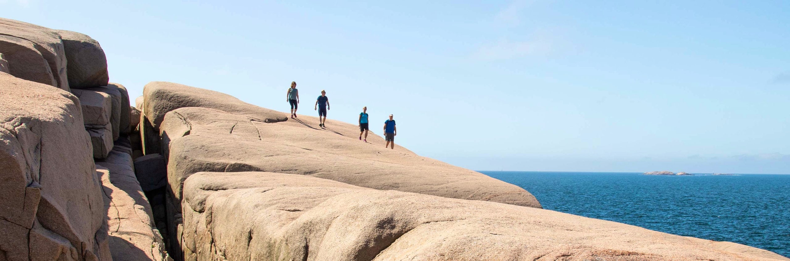
Along Tjustleden you walk through what makes the Tjust district so characteristic: varied farmland, open oak and pine forests, dense coniferous forest, views across lakes and mires, the history of the ironworks communities, and finally the calm waters of the sea inlets outside Västervik. At times wild, at times lush, but always varied.
Things to see and do along the trail
The lakes along the trail offer bathing rocks and fine rest stops. On summer evenings you can hear the call of the black-throated loon across the water, and with a bit of luck you may spot a white-tailed eagle or osprey circling above. The trail follows old crofter roads and school paths where ruined crofts, clearance cairns and naturalised garden plants such as lilac and pollarded birches bear witness to a bygone era.
Don’t miss
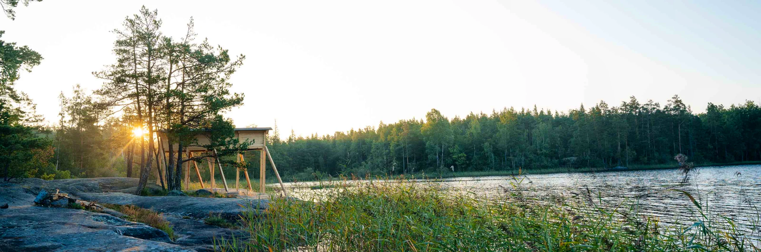
On stage 3, the abandoned mines at Käringryggen and the picturesque mill museum at Valstad await. Towards the end of the hike you pass Törnsfalls kyrka – one of only two preserved medieval churches in Tjust. And don’t miss the architect-designed Arknat shelters.
Getting to the trail
A bus stop is located in Mörtfors by the E22 between Västervik and Oskarshamn. Kalmar Länstrafik (KLT) operates the route. Västervik has bus and train connections.
Trail markings
Standard markings for Swedish lowland trails: orange blazes on trees and posts, supplemented by metal posts with blue “Tjustleden” signs showing distances at strategic locations such as all stage endpoints with shelters and dry toilets.
Stages on Signature Trail Tjustleden
Stage 1: Mörtfors–Getgölen
19 kilometres, 6–7 hours of hiking
Accommodation: Wind shelter or tent
The trail starts just west of Mörtfors and follows the shore of Stora Ramm through a varied landscape of steep rock faces, giant spruces and lush shoreline vegetation. At Ramnesund you pass the first traces of a bygone era – the grey stones of a ruined croft and a burial cairn at the forest edge – and throughout the stage the trail follows old cart roads that once served as school paths for the area’s crofts. Garden plants such as lilac, whitebeams and pollarded birches mark where the farmsteads once stood. Moose and ravens are common companions, ospreys fish in the lakes and the black-throated loon calls on summer evenings. The stage ends just west of Getterum, one of the oldest settlement sites in Hjorted parish, surrounded by ancient remains and with an old market site on Åsen that is still used every year. If you prefer not to hike the full stage, you can stay in a spectacular, architect-designed Arknat shelter by the northern point of Tällsjön, roughly halfway along. The stage ends at the lake Lilla Getgöl, where you will find a shelter and dry toilet.
Stage 2: Getgölen–Svarteström
18 kilometres, 6–7 hours of hiking
Accommodation: Wind shelter or tent
The stage begins across open pastures and passes Abborregöl, where the rare carnivorous plant sundew thrives along the shore, and Uddekvarn with its old dams and spring-flowering banks. Northwest of Hjorted, where you can shop groceries, Långsjön opens up, once an important steamboat route between the local communities. At the lake Isgölen you cross Isholmen on two bridges before reaching the lake Stora Flugen, where the stage ends at a shelter.
From here, you can make a detour along the Ankarsrum loop, which passes another Arknat wind shelter and continues to the mill town of Ankarsrum. Once there, you can visit the ancient hillfort at Borgberget with its wide views and stock up on supplies. At Långsjöns camping, there is an option to stay overnight. From Ankarsrum, there is also a heritage railway connecting to Hultsfred and Västervik, as well as bus connections to Vimmerby and Västervik.
At Svarteström you pass a power station from the late 1800s that still harnesses the waterfall which once supplied Ankarsrum ironworks with electricity.

Stage 3: Svarteström–Valstad kvarn
18 kilometres, 6–7 hours of hiking
Accommodation: Wind shelter or tent
The stage begins with a fine view over Stora Flugen from the rocky ridge and continues through varied terrain past the ruined croft Fagertorp and the farmstead Ekenäs, flanked by two lakes and Bronze Age cairns by the shore. Further on, the abandoned mines at Käringryggen await – three mining fields on a clearcut hilltop where information boards tell the story of iron mining and the subsequent remediation.
Shortly after the mines, you pass Lunds by, one of the county’s best-preserved village environments. Here, eight traditional Falun-red farmsteads are arranged around a square courtyard in a family village dating back to the late 17th century. Parts of Astrid Lindgren’s “Bullerbyn” were filmed here.
The stage ends at Valstads kvarn, a living mill museum set in the meandering landscape of the Verkebäck valley, where the water winds its way toward the Baltic Sea. From here, it is a short distance to the village of Verkebäck, with bus connections along the E22 and a station for the narrow-gauge railway – a great option for those who want to split the hike or finish earlier.
Stage 4: Valstad kvarn–Västervik
22 kilometres, 7–8 hours of hiking
Accommodation: STF Västervik Hotell Park
The trail runs through quiet forest past the remains of the croft Soluppgång and reaches the lake Hjorten, a crystal-clear drinking water source for Västervik since 1923, with osprey and black-throated loon as constant companions. At Törnsfall, where you can visit one of only two preserved medieval churches in all of Tjust, the connecting trail takes over and leads you the final eight kilometres towards Västervik. The route crosses the ridge Dunhällarna, through a magnificent Bronze Age landscape with some twenty cairns and stone settings, and past the inviting bathing spots at the lake Gagern before the trail ends at Marsbäcken on the outskirts of Västervik. Just before Marsbäcken, you’ll find another spectacular Arknat shelter where you can spend your final night. From there, follow the waterfront promenade into the town centre or catch the bus from Gertrudsvik. STF Västervik Hotell Park, Hotell Fängelset and several other hotels are located near the central station.
Photos: Västervik Framåt
More pages about hiking

All about hiking
On this page you will find helpful tips and information for your hike.

Hiking trails in Sweden
On this page we present a selection of popular and high-quality trails across the country.
Signature trails
STF has selected some of the most spectacular routes in the country and brought them together under the name Signature Trails.