Signature trail Stockholm
From fresh to saltwater, this digitally marked trail winds through the National City Park of Stockholm. Close to Stockholm’s city center, you can experience a unique historic landscape intertwined with lush parks, beautiful buildings, forests, pastures, and beaches.
Along the way, you’ll also find numerous castles, estates, and a variety of cafés, restaurants, and swimming spots. Signature trail Stockholm is one of STF’s signature trails.
Quick facts
Map of Signature trail Stockholm
Navigate past map or other external content.This map is a planning tool and should not replace a physical map and compass. The service “Naturkartan” (opens in new tab) is operated by a company called “Outdoor map”. Please note that trail information is owned and updated by the respective trail administrator (e.g. municipality or county administrative board).
See and do along the trail
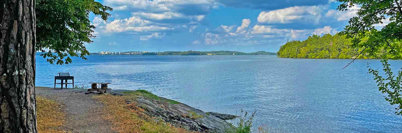
There’s plenty to see and do along this spectacular trail. The hike takes you through parks, forests, and open fields, as well as through some densely built-up areas. Along the way, you’ll find numerous castles, estates, and other beautiful buildings, along with a variety of cafés, restaurants, swimming spots, and picnic areas with grills.

Don’t miss
On the fist stage between Kallhäll and Barkarby, the trail passes one of Stockholm’s quietest spots. On stage 2, you’ll pass both Eggby Farm and Överjärva Farm, which offer seasonal café service. On Stage 3, the trail takes you past both Ulriksdal Palace and Haga Palace. In stage 4, you’ll encounter Rosendal’s Gardens.
Transport to the trail
Regardless of which stage of the trail you plan to hike, use the digital map as your guide. If you’re starting from Stockholm Central Station and want to hike the stages in numerical order (1-4), take the commuter train to Kallhäll Station, about a 25-minute ride. If you want to hike in reverse order (4-1) and are starting from Stockholm Central, it’s easiest to walk to Skeppsholmen. Alternatively, take the blue subway line (one stop) to Kungsträdgården and walk from there to Skeppsholmen.
Trail markers
The Signature trail Stockholm does not have its own physical trail markers. Instead, it follows other marked trails. Use the digital map as your guide.

Stages of the Signature trail Stockholm
Stage 1: Kallhäll Station–Barkarby Station
17 kilometers, 5–7 hours of hiking
This stage begins at Kallhäll commuter train station and follows the Upplandsleden trail through Görväln Nature Reserve, ending at Barkarby commuter train station. Follow the orange Upplandsleden markers all the way to the endpoint. The trail features beautiful pine forests, farmland, and wide views over Lake Mälaren, with opportunities to swim along the way. You can refill water at the Görväln Castle rest cabin, which is open to hikers. A castle café is also available with seasonal hours. Below Kvarnberget, there is a large swimming area and kiosk. You might also enjoy visiting the ancient fort at Sandvik. Numerous rest areas along the trail offer grill spots, though you may need to bring your own firewood or charcoal. Be mindful of any fire restrictions. The stage also passes one of Stockholm’s quietest places. The last part of the hike is mostly on asphalt as you approach Barkarby station.
Stage 2: Barkarby Station–Överjärva Farm
10 kilometers, 3–4 hours of hiking
This stage begins at Barkarby station and takes you across Järvafältet, continuing through Igelbäcken Nature Reserve with an endpoint at Överjärva Farm. Initially, the route follows paved paths, then transitions to a mix of gravel and trail through farmland and pastures, with some illuminated forest paths. Stop by the café at Eggby Farm or plan a longer break at the charming Överjärva Farm café (seasonal hours). The closest train station from Överjärva Farm is Ulriksdal, about 1 kilometer away.
Stage 3: Överjärva Farm–Gärdet Subway Station
20 kilometers, 5–8 hours of hiking
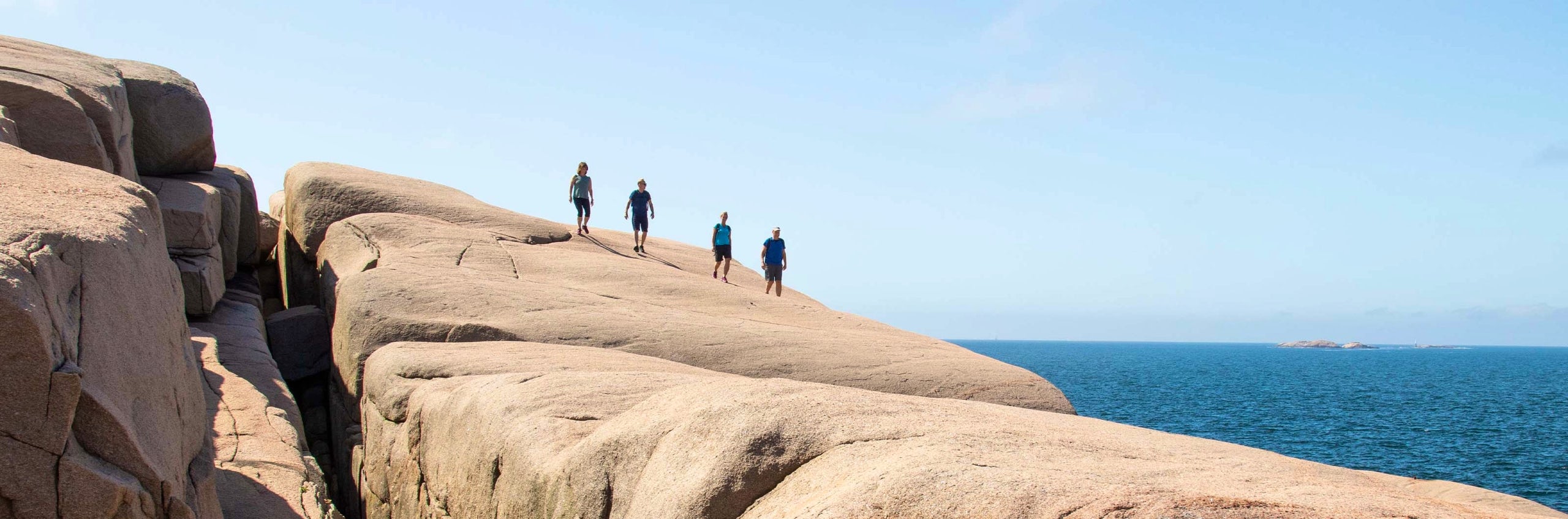
To reach the starting point, take the commuter train to Ulriksdal Station, then walk about 1 kilometer to Överjärva Farm. This stage initially heads towards Ulriksdal Palace and its park. Along the beautiful shores of Edsviken and Brunnsviken, the salty waters of the Baltic Sea flow in. In Brunnsviken, you’ll find lush Hagaparken, the Bergius Botanic Garden, and the Butterfly House. After Lappkärrsberget, the trail continues through peaceful forested paths in Stora Skuggan, where the bustle of the city feels far away. There are plenty of cafés, restaurants, rest areas, and lovely swimming spots along the trail. The endpoint at the southern entrance of Gärdet station is just three stops on the red subway line from T-Centralen.
Stage 4: Gärdet Subway Station– STF Stockholm Skeppsholmen Hostel
14 kilometers, 3–5 hours of hiking
For this stage, take the red subway line to Gärdet station and choose the southern exit towards Gärdet. The trail initially leads across Ladugårdsgärdet, past Kaknästornet, and into the meadows of Norra Djurgården. Along the way, you’ll pass several museums, attractions, restaurants, and cafés. In Kaknäshagen, the trail meets the sea and follows the northern shore of Djurgården, rounding Blockhusudden and continuing along the scenic waterfront promenade to Valdemarsudde. If you prefer a shortcut to the endpoint, you can take the Djurgården ferry from Gröna Lund to Skeppsholmen. Alternatively, continue on foot past Rosendal’s Gardens and Palace, through Djurgårdsbrunnsviken, and across Djurgårdsbron. Finally, enjoy a picturesque city walk along Strandvägen, through Nybroplan, Blasieholmen, and to your destination at STF Stockholm Skeppsholmen Hostel. This might be the perfect moment for a refreshing drink on the sun deck?
Accommodation along the trail


STF Zinkensdamm Hotel & Hostel Stockholm
More pages about hiking

All about hiking
On this page you will find helpful tips and information for your hike.

Hiking trails in Sweden
On this page we present a selection of popular and high-quality trails across the country.
Signature trails
STF has selected some of the most spectacular routes in the country and brought them together under the name Signature Trails.