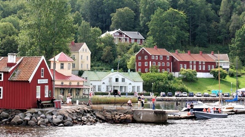
Signature trail Gothenburg
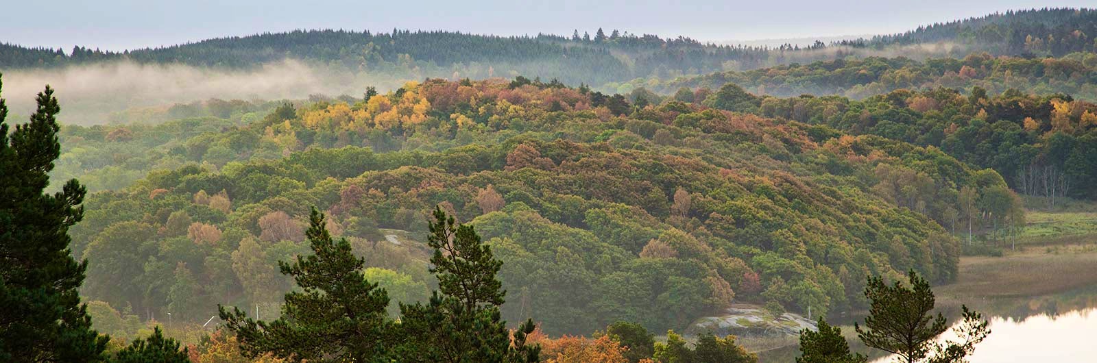
The Signature trail Göteborg consists of six selected stages from the southern part of the Bohusleden trail, winding along the outskirts of Gothenburg. Despite its proximity to the city, you hike in peaceful silence through several nature reserves, past fish-rich lakes and beneath dense beech forests.
The stages vary in length, and at the end of each day you’ll find comfortable accommodation. A perfect six-day hike from Älsvåker to Kungälv/Fontin. The trail is one of STF’s Signature trails – a particularly scenic and quality-assured multi-day hiking experience.
Quick facts
Map of Signature trail Göteborg
Navigate past map or other external content.This map is a planning tool and should not replace a physical map and compass. The service “Naturkartan” (opens in new tab) is operated by a company called “Outdoor map”. Please note that trail information is owned and updated by the respective trail administrator (e.g. municipality or county administrative board).
Discover the Signature trail Göteborg
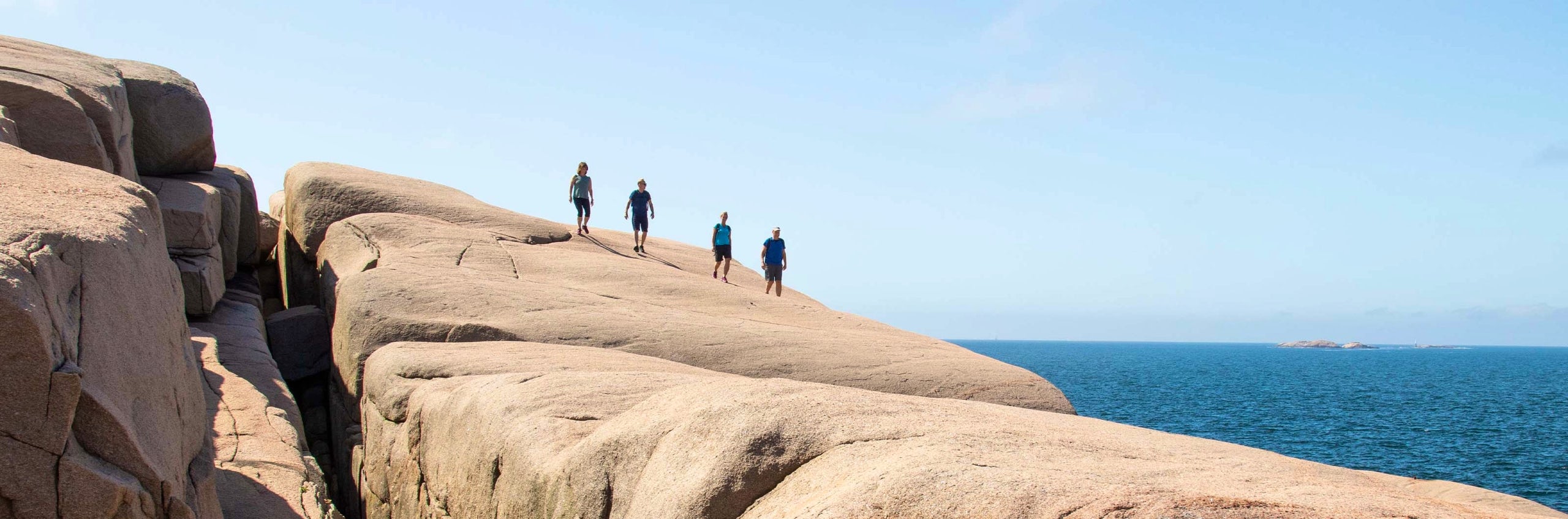
The Signature trail Göteborg passes through Halland, Västergötland and Bohuslän. On your second day, you hike through the Delsjö area – the first of a total of seven nature reserves you’ll experience along the trail, each with its own distinct character. On day three, the trail leads through dramatic ravines and rocky landscapes in Knipeflågsbergen nature reserve, home to wildlife such as moose, deer and fox. A few days later, you pass through Bokedalen nature reserve, known for its magnificent beech forest. In spring, the landscape is covered in wood anemones.
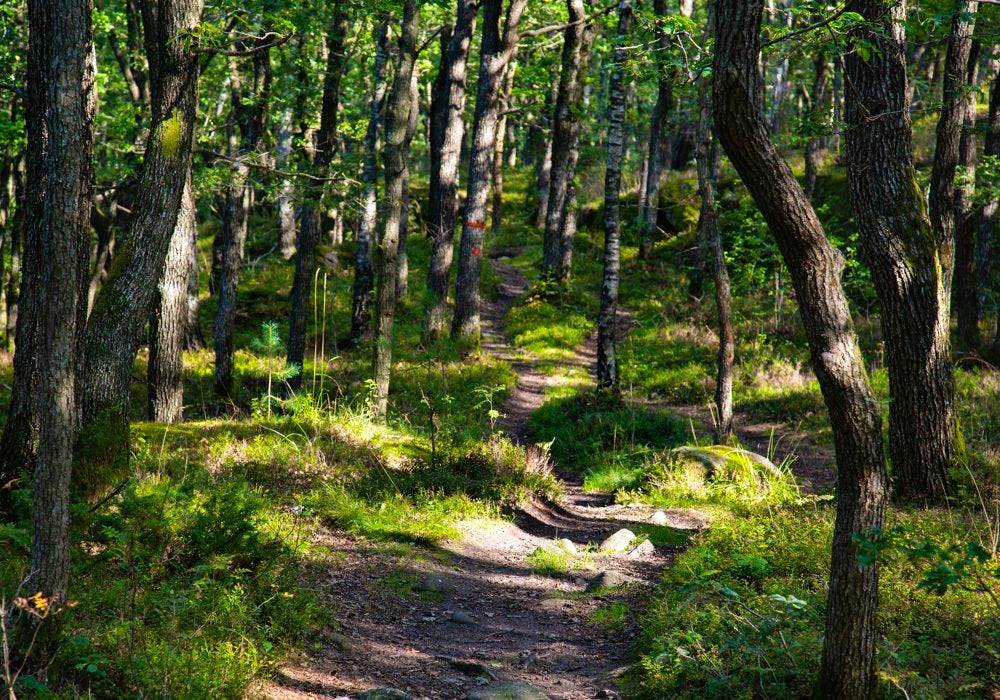
The final stretch ends with a gentle uphill hike through the built-up area of Fontinberget in Fontin nature reserve. You can choose to finish the last day in Angered after 11 kilometers, or continue to Kungälv/Fontin after 27 kilometers. Each stage offers one or more rest areas, as well as several swimming spots. The terrain consists of trails or gravel roads, with shorter sections on asphalt. Bring water and lunch from the start each day, as availability along the way may be limited.
See and do along the trail
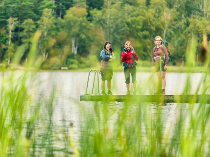
Swimming is mandatory, as the trail often runs alongside lakes and past swimming spots. The proximity to Gothenburg also makes it easy to enjoy the city’s wide range of offerings before or after your hike.
Don’t miss
On day three, you pass Blacktjärn about halfway along the stage. According to legend, the tarn is guarded by seven different spirits – call out across the water and see what happens! You’ll also pass Bohus fästning, which is well worth a visit.
Transport to the trail
You can easily reach the start of the stage from Anneberg commuter train station, and there is also a bus stop at Älvsåkergården. At the starting point, you’ll find a large gravel parking area if you are arriving by car. If you prefer to shorten the rather long first stage, you can just as easily start in Lindome or Kållered instead.
To return to Gothenburg Central from the end point in Angered or Kungälv/Fontin, you can take bus and train. If you’re heading back to Gothenburg after your final day, you can take a bus from the stop near Bohus fästning, instead of continuing past the fortress into Kungälv or further up to Fontin.
If you’d like to start your hike in central Gothenburg, you can follow Gotaleden Stage 1 from Kungsportsplatsen to Skatås, where you connect to the Signature trail’s stage 3. The distance is 6 km and is marked with Gotaleden’s blue symbol. Read more about Gotaleden (opens in new tab).
Trail markers
The trail is marked with orange paint. New signs were installed in 2019, but they are not present throughout the entire trail. Older signage can also still be found along the way.
Stages of Signature trail Göteborg
Tip! Spend the first or last night at STF Wendelsberg Hotel & Hostel Göteborg or STF Stigbergsliden Hostel Göteborg.
Stage 1: Älvsåker – Stensjön
26 km, 8–9 hours of hiking
Accommodation: Hotell Eken in Kållered (opens in new tab)
The stage begins in Älvsåker in Kungsbacka municipality, where the Bohusleden and Hallandsleden trails meet. If the distance feels too long, it is recommended to start instead in Lindome or Kållered, shortening the stage by 9 or 15 km.
Älvsåker offers access to public transport, parking and the option to have lunch. The first stretch takes you through untouched forest, where you may spot the rare long-stranded beard lichen on thick tree trunks. The hike alternates between deep forests, open meadows and farmland, passing several lakes ideal for swimming – bringing swimwear is highly recommended.
After just three kilometers, you reach the first wind shelter at Blåvättnerna, and shortly after you pass Bunketorp outdoor recreation area with rest areas. The Bohusleden then leads you through Lindome and Kållered, where you can resupply, have lunch or take the train onward. After a couple of hours in urban nature, the trail returns to the forest, where you’ll find another wind shelter by Lake Hörsickan.
Stage 2: Stensjön – Skatås
9 km, 3 hours of hiking
Accommodation: Lisebergsbyn (opens in new tab)
The stage starts on the northeastern side of Stensjön, accessible by bus. After passing under road 40, you enter Delsjön nature reserve. The trail follows closely along Stora Delsjön for a couple of kilometers before turning north toward Skatås. Several swimming spots are available along the way. There is no access to water or food along the stage. The accommodation Torpet Mon is located a few hundred meters west of the trail as you approach Skatås. It is open during summer and on weekends the rest of the year upon booking. Camping is not allowed, as it is located within a park. Restaurants are available within 1.5 km of the accommodation.
Stage 3: Skatås – Kåsjön
10 km, 2–3 hours of hiking
Accommodation: Partille Vandrarhem (opens in new tab)
This day offers an exciting stretch through Knipeflågsbergen nature reserve. Rugged rock formations and dramatic ravines surround parts of the trail. The area is rich in wildlife such as moose, fox and deer. The trail takes you up to Getryggen, where you are rewarded with sweeping views over Gothenburg. About halfway, you pass the mythical Blacktjärn. Despite slightly hilly terrain, with the highest point at 140 meters above sea level, the stage is easy to hike. There is no access to water or food along the stage. Partille Vandrarhem is located one kilometer north of Kåsjön bathing area. Self-catering kitchen available.
Stage 4: Kåsjön – Jonsered
8 km, 2–3 hours of hiking
Accommodation: Le mat Jonsered (opens in new tab)
From Kåsjön, you hike along trails through mixed forest terrain. After about a kilometer, you pass Lake Madren. A rest area is located midway along the stage. The industrial village of Jonsered was developed by the Scotsman William Gibson, which has given the area a distinct Scottish character, including its brick buildings. The accommodation is located in one of these buildings at Jonsereds Fabriker. A self-catering kitchen is available, and breakfast is served year-round. Restaurants can be found in Jonsered. There is no access to water or food along the stage.
Stage 5: Jonsered – Angereds Kyrka
12 km, 3–4 hours of hiking
Accommodation: STF Stigbergsliden Hostel Göteborg
The stage passes through dense beech forests in Bokedalen nature reserve. Shortly after the start, near Jonsereds Herrgård, the trail splits into two alternative routes. The route along Lake Aspen is slightly longer. The trails rejoin at the cottage Freden. After the strait between Stora and Lilla Ramsjöarna, there is a viewpoint well worth a visit. There is no access to water or food along the stage. The hike can end here, with public transport taking you back to Gothenburg Central, where you can stay at STF Stigbergsliden Vandrarhem.
Stage 6: Angereds Kyrka – Kungälv/Fontin
17 km, 6–8 hours of hiking
Accommodation: STF Stigbergsliden Hostel Göteborg, Nordiska Folkhögskolan Konferens och B&B (opens in new tab)
A longer alternative is to continue to Kungälv. After Angered, the trail passes through Vättlefjäll nature reserve, an area rich in wetlands and lakes. The final stretch up to Fontin in Kungälv is well worth the effort. Several rest areas and swimming spots are found along the way. There is no access to water or food along the stage. After completing the hike, you can take public transport from Kungälv back to Gothenburg Central.
STF accommodation nearby

STF Stigbergsliden Hostel Göteborg

STF Gustafsberg Seaside Hotel & Hostel


STF Wendelsberg Hotel & Hostel Göteborg
More pages about hiking

All about hiking
On this page you will find helpful tips and information for your hike.

Hiking trails in Sweden
On this page we present a selection of popular and high-quality trails across the country.
Signature trails
STF has selected some of the most spectacular routes in the country and brought them together under the name Signature Trails.