
The Femundsmarka trail
This hike takes you from Grövelsjön Mountain Station to Svukuriset Turisthytte, a Norwegian mountain lodge. You follow a marked summer trail across the mountains, passing through the scenic Femundsmarka National Park, with its twisted old pine trees and small lakes. In the evenings, you can sit down at a set table and enjoy well-prepared meals - right in the heart of the mountains.
Quick facts
Discover the Femundsmarka trail
On this hike, you’ll experience mountain stations in both Sweden and Norway. On the Swedish side, you’ll stay at Grövelsjön Mountain Station, and on the Norwegian side, at Svukuriset Turisthytte. Svukuriset, a converted mountain farm, is situated right next to the wilderness of Femundsmarka National Park. This stunning park features a primeval landscape dotted with countless boulders left behind by the glaciers. You’ll hike among lichen-covered pine trees and numerous small lakes. The trail mostly runs across open mountain terrain, with shorter sections passing through mixed forest.
Both mountain stations take pride in serving well-prepared meals featuring local ingredients. This means your hiking tour will have a touch of luxury, you can even look forward to freshly baked bread for breakfast.
Learn more about how to avoid disturbing the reindeer.

See and do along the trail
Enjoy a boat ride on Lake Femunden during your visit to Svukuriset Turisthytte.
Don’t miss
Stay an extra night in Norway and hike Stor-Svuku, 1,416 meters above sea level. It’s the most popular day hike from the Norwegian mountain cabin.
Transport to the trail
Book your train ticket via SJ (opens in new tab). Search for your journey all the way from your departure location to the final destination, in this case, STF Grövelsjöns Fjällstation. This way, you will see departure options that combine different modes of transport: both train and bus. You also get a travel guarantee, ensuring any delays won’t prevent you from reaching your destination. There are train connections to Mora, followed by a bus.
Grövelsjön has daily bus connections with Mora (approx. 3.5 hours). See the Dalatrafik website (opens in new tab) for the current timetable.
Sections of the Femundsmarka trail
Below, you’ll find information on accommodations, sections with distances, and other relevant hiking details.
Of course, you can hike in the opposite direction from the order of sections described here.
Section 1: STF Grövelsjön Mountain Station–Svukuriset Turisthytte
23 kilometers, 7–8 hours of hiking
Accommodation: DNT Svukuriset Turisthytte (opens in new tab) not STF accommodation
You start by hiking down to Lake Grövelsjön. From there, the trail heads northwest, ascending to the pass between Sjöhöjden and Salsfjället. At an altitude of 1,060 meters, the trail then descends towards Sylen, located at the northern end of Lake Grövelsjön.
You can also take a boat from Sjöstugan across Grövelsjön to Sylen, to shorten the hike to Svukuriset to 16 kilometers instead of 22.
From the northern end of Lake Grövelsjön, follow the summer trail that climbs steeply up the slope of Sjöhöjden. Here, you’ll be rewarded with stunning views over Lake Grövelsjön and the farms in Sylen. The trail continues towards Rönnsjön and through a forested area before gradually ascending along the edge of the mountain Revlingkletten. The final stretch to Svukuriset takes you through forest.
Section 2: Svukuriset Turisthytte–STF Grövelsjön Mountain Station
23 kilometers, 7–8 hours of hiking
Accommodation: STF Grövelsjön Mountain Station
The return to Grövelsjön begins with a forested path heading south towards Revlingsjöarna. You then continue up towards the pass between Forborgen and Elgåhogna until you reach the point where the trails diverge. From here, follow the path leading back to Grövelsjön Mountain Station via Salsfjället.
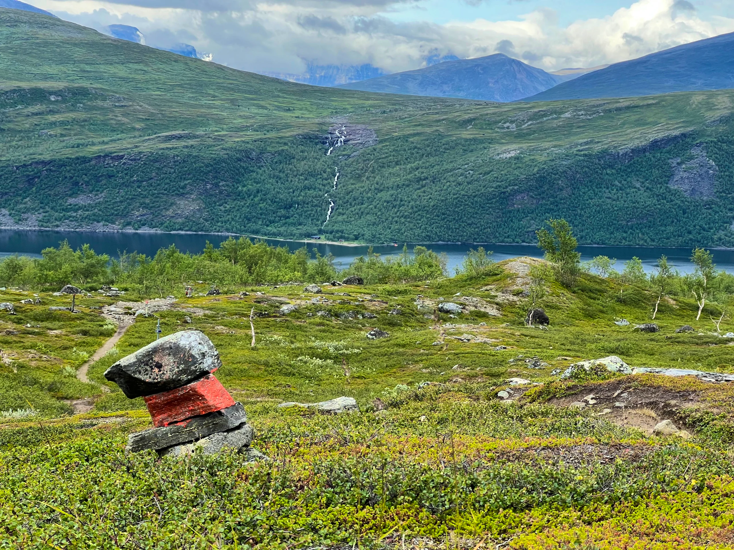
Trail markings
Check the trail markings before you set out. Winter trails are marked with crosses, while summer trails are marked with painted poles, stones, or trees. Winter trails can be difficult to follow in summer, so use a map and trail signs to navigate.
Read more about the trail systemMore pages about hiking

Selected hiking trails
On this page we present a selection of popular and high-quality trails across the country.
STF’s Signature Trails
STF has selected some of the most spectacular routes in the country and brought them together under the name Signature Trails.

Hiking
On this page you will find helpful tips and information for your hike.