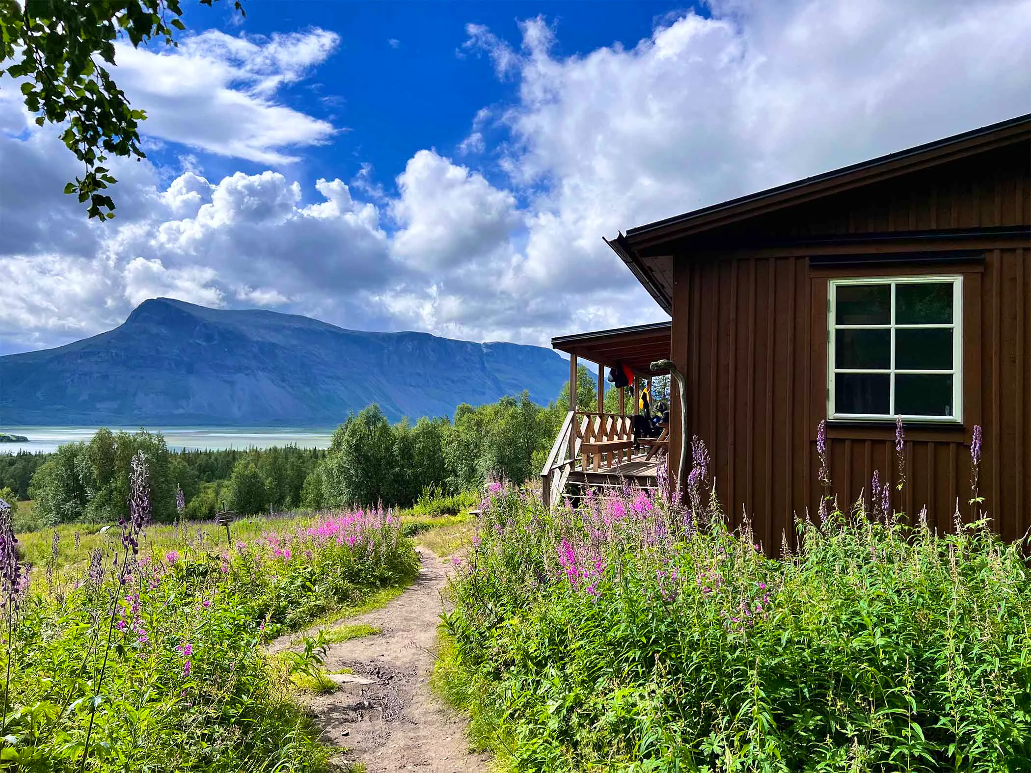
Ritsem – Aktse
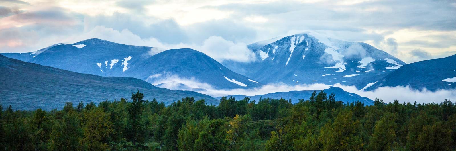
In Sarek National Park, you’re hiking in true wilderness. Several mountains rise over 2,000 meters above sea level, and there are more than 100 glaciers. The landscape is breathtaking and is part of the Laponia World Heritage Site.
However, this hike requires experience, as the area is exposed to harsh weather conditions and lacks marked trails or overnight cabins. Some routes, especially the valleys that form the entrances to the park, can be quite popular. Below is a description of the section from STF Ritsem Mountain Cabin to STF Aktse Mountain Cabin.
Quick facts
Map of the trail Ritsem – Aktse
Navigate past map or other external content.This map is a planning tool and should not replace a physical map and compass. The service “Naturkartan” (opens in new tab) is operated by a company called “Outdoor map”. Please note that trail information is owned and updated by the respective trail administrator (e.g. municipality or county administrative board).
Discover Sarek National Park
Sarek is a challenging and weather-exposed area. Knowledge of map and compass use is essential for anyone planning a trip here. Additionally, you should be comfortable carrying a heavy pack, as you’ll need to bring a tent, sleeping gear, and provisions. The reward, however, is an extraordinary experience. Sarek, along with the national parks of Muddus, Padjelanta, and Stora Sjöfallet, is part of the Laponia World Heritage Site, Europe’s largest continuous natural landscape, almost entirely untouched by human activity.
There are many ways to plan a trek in Sarek, with some routes being fairly well-traveled. These include the valleys that serve as entrances to the park. STF Saltoluokta Mountain Station is one of several starting points. From here, after a day’s hike, you can reach valleys like Pastavagge and Pielaslätten, often referred to as the heart of Sarek.
Hikers starting from Kvikkjokk often follow the Kungsleden northward, passing through STF Aktse to enter the Rapadalen valley and then continue into Routesvagge. STF Aktse can also be reached after two days of hiking from STF Saltoluokta Mountain Station. Another popular starting point is Sourva, which provides access to Sarek’s central areas.
For those approaching from the north, Sarek is most easily reached via the Padjelantaleden trail. The route described below follows this path, from STF Ritsem Mountain Cabin to STF Aktse Mountain Cabin.
Learn more about how to avoid disturbing the reindeer.
Please note that these areas are also home to large predators. Leashed dogs are permitted in the national park from January 1 to April 30. During the rest of the year, dogs are not allowed in the park.
See and do along the trail
There are wonderful summit tours to enjoy along the route, such as Áhkká in Stora Sjöfallet National Park and Niják within Sarek, at the northern gateway to the Ruohtesvágge valley.
Don’t miss
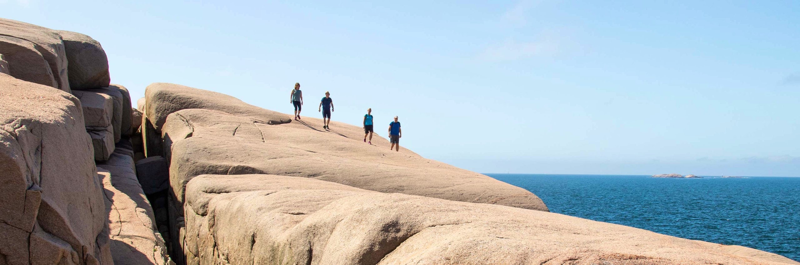
Hiking through Sarek includes many challenging river crossings. It’s essential to be very cautious here. Learn more about river crossings and wade safely.
Transport to the trail
Book your train journey via SJ (opens in new tab) and search for a route from your departure point to your final destination, in this case, Ritsem. This way, you’ll see departures that connect train and bus services. Additionally, you’ll have travel guarantees that ensure you’ll still reach your destination in case of delays. You can reach Gällivare by train or by air, followed by a bus journey.
The route depends on which trail section you choose and where you plan to enter the national park. Here’s how to reach Ritsem:
STF operates boat transportation across Lake Langas.
Stages of Ritsem – Aktse
The following sections from Ritsem Mountain Cabin to Aktse Mountain Cabin lead you through Sarek National Park. Each stage is presented with distances, accommodations, and other relevant hiking information.
You can, of course, hike in the opposite direction to the order presented.
Section 1: STF Ritsem – STF Akka Mountain Cabin
Boat ride for 2 kilometers, 1 hour hike
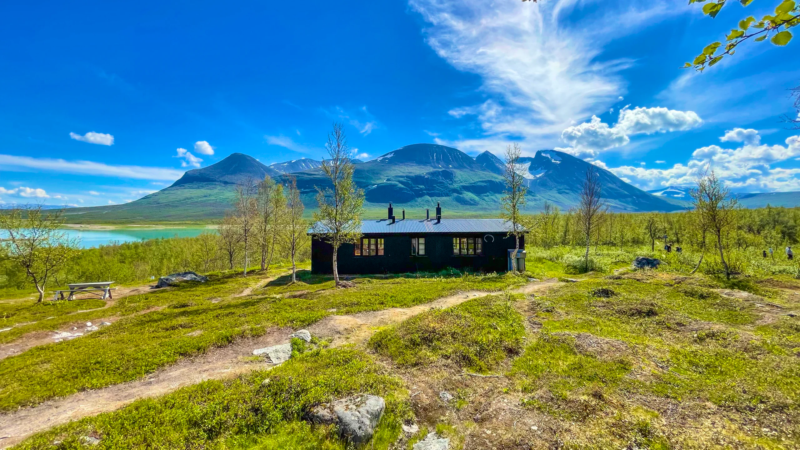
Accommodation: STF Akka Mountain Cabin
On the first day, you’ll take a boat from Ritsem across Lake Ahkkajaure to Änomjálmme. After just two kilometers of hiking, you reach STF Akka Mountain Cabin. To the east lies Mount Áhkká, rightly called the Queen of Lapland. Many consider the view from the cabin to be one of Sweden’s most beautiful.
Section 2: STF Akka Mountain Cabin – Kisuris Cabin
14 kilometers, 6–7 hours of hiking
Accommodation: Kisuris Cabin (not STF)
On the second day, you hike into Stora Sjöfallet National Park via the Padjelantaleden. Padjelanta is Sweden’s largest national park. The trail follows the base of Mount Áhkká, and the sound of the rushing Vuojatädno River accompanies you for much of the section. On clear days, you can already see Sarek’s snow-capped peaks. The terrain is easy to hike on trails and boardwalks, through birch forests and marshlands.
Section 3: Kisuris Cabin – Niak
19 kilometers, 7–8 hours of hiking
Accommodation: Tent
At Kisuris Cabin, you leave Padjelanta and enter Sarek. The trail follows the Sjinjuvtjudisjåhkå River for the first few kilometers. Shortly after the old Kisuriskåta Cabin, you turn south into the 17-kilometer-long Ruohtesvágge valley. The path is well-trodden and passes marshlands, grass heaths, and moraine banks. Great camping spots are found on a large grassy plain at the valley junction between Nijákvágge, Sierggavágge, and Ruohtesvágge.
Section 4: Niak – Skárjá
19 kilometers, 7–8 hours of hiking
Accommodation: Tent
You will spend the entire day walking through the green and lush Ruohtesvágge Valley. The path is easy on grass heaths, running along the south side of the Smájlajiåhkå River all the way to your destination. On your left, you’ll have the towering Sarektjåhkå massif throughout the day. There’s an exciting canyon at Skárjá. You’ll find plenty of nice camping spots at Skárjá, as well as a toilet and an emergency phone.
Section 5: Skárjá – Skårki Cabin
22 kilometers, 8–10 hours of hiking
Accommodation: Tent
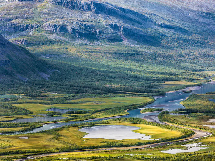
Leaving one beautiful valley, you enter another: Rapadalen. You continue on open mountain terrain north of the Ráphajåhkå River. At Spökstenen, 663 meters above sea level, the trail moves behind the northeast side of Mount Låddebákte. The highest point you’ll reach is around 1,000 meters before the landscape slopes downward. On the way down, you’ll have stunning views over the Rapaselet and its winding delta.
Section 6: Skårki Cabin – Alep Vassjájågåsj
About 14 kilometers, 6–7 hours of hiking
Accommodation: Tent
The trail winds between the impressive vertical south wall of Stuor Skoarkki on your left and Rapaselet on your right. As you progress through the valley, the vegetation becomes more lush. Upon reaching the mouth of the Alep Vassjájågåsj River, you leave the trail in Rapadalen and ascend the mountainside. To the east of Alep Vassjájågåsj, you’ll find one of Sarek’s most photographed campsites. Don’t forget to bring water from the valley below.
Section 7: Alep Vassjájågåsj – Aktse Mountain Cabin
About 19 kilometers, 7–8 hours of hiking
Accommodation: STF Aktse Mountain Cabin
This entire stretch runs along the elevation – roughly 1,000 meters above sea level – with views over Rapadalen’s delta landscape. The terrain consists of easy grass heaths, though with some challenging river crossings even up here. Near the Skjerfe summit, you join a path that leads down to Kungsleden and STF Aktse Mountain Cabin.
An alternative route is to hike through all of Rapadalen to the Laitaure Delta and take a boat transfer to STF Aktse Mountain Cabin. From Aktse, you can choose to hike north to STF Saltoluokta Mountain Station or south to Kvikkjokk Mountain Station. Both options involve two days of hiking.
No marked trails in Sarek
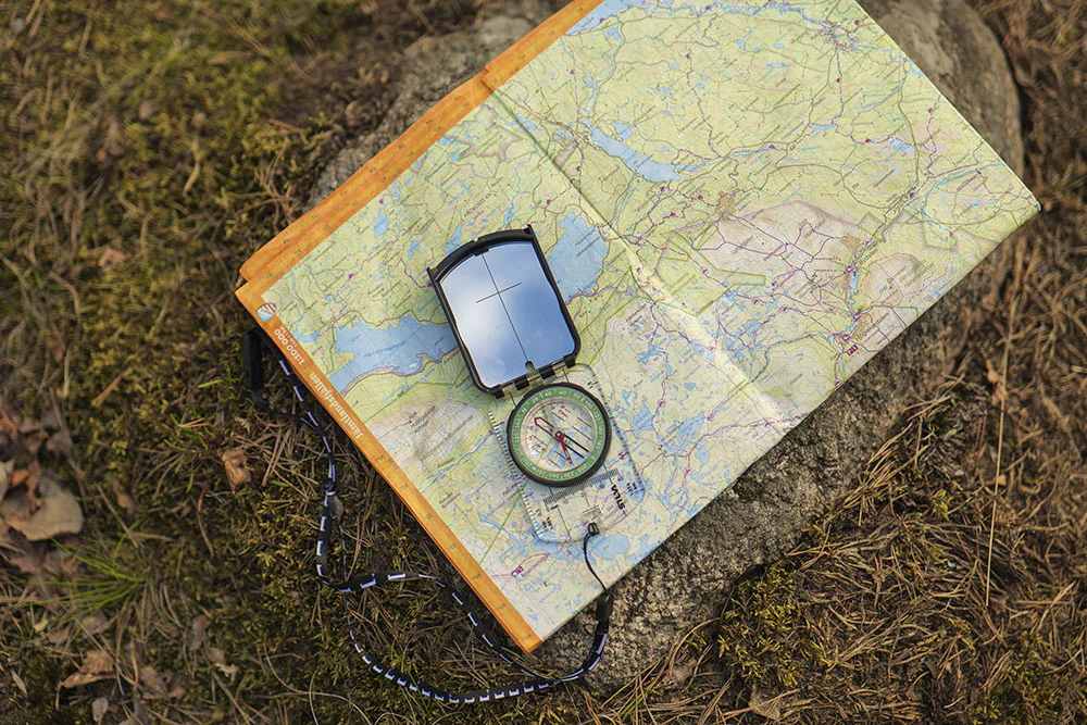
There are no marked trails within Sarek National Park. A map, compass and good navigation skills are therefore essential.
Read moreAccommodations along the trail

More pages about hiking

Selected hiking trails
On this page we present a selection of popular and high-quality trails across the country.
STF’s Signature Trails
STF has selected some of the most spectacular routes in the country and brought them together under the name Signature Trails.

Hiking
On this page you will find helpful tips and information for your hike.