E-path 1
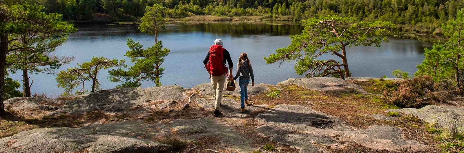
E1 in Sweden is a scenic hiking trail that runs from Halmstad to Grövelsjön. The E1 was inaugurated in 1992 and has a total length of approximately 1,200 kilometres in Sweden.
E1 in Sweden – the trail in brief
E1 in Sweden was inaugurated in 1992. It starts in Halmstad in the south and ends at the Grövelsjö Mountains in northern Dalarna. At present, hikers cannot take the ferry between Grenaa and Halmstad; see the suggested alternative route below. From Grövelsjön, you can continue into Norway all the way to Nordkapp. From Denmark, the trail continues south through Germany, Switzerland and Italy, all the way to the Mediterranean coast. If you stay on the equally beautiful Swedish sections, you will encounter varied trails mostly in lowland landscapes, except in the north where you hike through magnificent mountain terrain.
The Swedish section of E1 covers approximately 1,300 kilometres of trails linking together Hallandsleden, Bohusleden, Vildmarksleden, Sjuhäradsleden, Västra Vätterleden, Bergslagsleden, Malingsbo-Klotenleden, Sméleden, Gagnefs fäbodstigar, Romboleden, Siljansleden, Vasaloppsleden and Södra Kungsleden.
Please note that E1 consists of connected regional trails where different municipalities, regions, foundations and other organisations are responsible for maintenance, markings, and updating information about signage and trail maps. Unlike trails such as Kungsleden in northern Sweden, there is no continuous network of STF mountain huts or emergency shelters along the route. The standard of rest shelters, wind shelters and overnight cabins may vary between trails. In some cases, short transport sections between different trails may occur.
Grenå – Halmstad – recommended alternative route
The ferry between Grenaa and Halmstad, operated by Stena Line, runs only once per day and currently does not accept hikers due to traffic issues in the Port of Halmstad.
We recommend the following alternative route when passage to Halmstad is not possible:
- In Denmark, continue along Hærvejen to Frederikshavn. Hærvejen runs from Padborg to Frederikshavn.
- Take the Stena Line ferry between Frederikshavn and Gothenburg. This ferry runs several times per day and accepts hikers.
- Join or leave the E1 in Gothenburg. You can use apps such as Naturkartan to navigate within Gothenburg.
STF accommodation nearby: STF Halmstad Gårdshotell
Hallandsleden (Halmstad – Simlångsdalen – Lindome/Blåvattnerna)
The first stage of E1 in Sweden starts at Halmstad Central Station and leads towards Simlångsdalen. The trail partly follows the Fylleån valley and partly the old railway embankment of the Bolmen railway, making it easy to hike.
In Simlångsdalen you continue north along Hallandsleden, then choose the western route towards Lindome/Blåvattnerna. This section of Hallandsleden is mainly easy to hike and passes through varied landscapes with extensive forest. In addition to accommodation near the trail, there are shelters with toilets and fresh water approximately every 15 kilometres. Train and bus connections are easily accessible near the trail.
Distance: 218 km
Trail marking: Orange markings and blue signs with white text “Hallandsleden”
Tip: Read more about Hallandsleden (opens in new tab)
Trail maps and books:
The links below open in a new tab
Hallandsleden route planning tool, Vandra Hallandsleden (Calazo), Norra Halland 1:50,000 (Calazo), Södra Halland 1:50,000 (Calazo), Södra Göteborg 1:50,000 (Calazo), Naturkartan
STF accommodation nearby: STF Lydde Gård, STF Wendelsberg Hotel & Hostel Göteborg
Bohusleden (Lindome/Blåvättnerna – Skatås)
A small section of Bohusleden forms part of the E1. This applies from the county border with Halland in the south to Gothenburg, where the E1 leaves Bohusleden at Skatås.
This section of the trail takes you through deep forests, meadows and farmland, and along beautiful lakes. The trail also passes close to the scenic surroundings of Gunnebo House and Gardens. Parts of this section are included in Signature trail Göteborg.
Distance: 30 km
Trail marking: The trail is well marked with orange markers and signs bearing the Bohusleden logo.
Tip: Read more about Bohusleden (opens in new tab)
Trail maps and books:
The links below open in a new tab.
Bohusleden route planning tool, Naturkartan
STF accommodation nearby: STF Stigbergsliden Hostel Göteborg, STF Wendelsberg Hotel & Hostel Göteborg
Vildmarksleden (Skatås – Hindås)
The trail runs between Skatås, not far from central Gothenburg, and Hindås. Halfway along the route there is road access at Härkeshult. The trail is relatively easy to hike, although a steep climb awaits those starting at the beginning of the trail. The landscape is varied and includes several lakes. Along the trail there are a number of shelters and rest areas.
Distance: approx. 38–42 km
Trail marking: The trail is currently not fully marked according to the national standard. Where markings exist, they consist of orange markers and signs with the Vildmarksleden logo.
The links below open in a new tab
Tip: Read more about Vildmarksleden
Trail maps and books: Gröna kartan, Naturkartan
Sjuhäradsleden (Hindås – Mullsjö)
Sjuhäradsleden is divided into 10 stages and begins in Hindås. It runs via Bollebygd, Borås and Ulricehamn, before ending in Mullsjö. The trail is easy to hike and takes you through varied landscapes, including forests, farmland and urban areas. There are several pleasant rest areas along the trail, and a few permanent wind shelters that can be used for overnight stays.
Please note that some sections of Sjuhäradsleden have been rerouted and these changes are not yet updated on naturkartan.se or on STF’s trail page for Sjuhäradsleden.
Distance: 140 km
Trail marking: The trail is well marked, except for some sections in Borås. Orange markers and signs with the Sjuhäradsleden logo.
Trail maps and books: Naturkartan (opens in new tab)
STF accommodation nearby: STF Årås Säteri & Trädgårdar, STF Nääs Slott, STF Dahlbogården
Västra Vätterleden (Mullsjö – Granvik/Stenkällegården)
This trail runs between Mullsjö (Mullsjö Friluftsgård, just south of Mullsjö) and Granvik (Stenkällegården) near Karlsborg. The trail is divided into eight stages and mainly passes through forest. It does not follow the shoreline of Lake Vättern, but instead runs further inland. There are many wind shelters along the trail.
Distance: 177–195 km
Trail marking: Maintenance and trail markings may vary between stages as they are managed by different municipalities. Orange markings painted on trees, posts and similar surfaces.
Tip: Read more about Västra Vätterleden (opens in new tab)
STF accommodation nearby: STF Villa Eira Hostel, STF Forsvik Hostel
Bergslagsleden (Granvik/Stenkällegården – Kloten)
The trail connects to Västra Vätterleden at Stenkällegården near Karlsborg. After about 280 kilometres, it ends in Kloten. Bergslagsleden passes through Tiveden and Kilsbergen before reaching the Bergslagen region. The trail is divided into 17 stages and offers varied hiking. Many shelters with toilets and often drinking water are available along the route.
Many stages are easy to hike, but some sections include steep elevation changes and rocky terrain. Along the way, you will encounter plenty of forests, lakes and traces of the region’s historic mining industry.
Distance: 280 km
Trail marking: The trail is well marked. Orange markers are used, although painted markings are gradually being replaced by bands with the Bergslagsleden logo. Blue arrows with the Bergslagsleden logo are placed on posts with an orange top. Circular routes along the trail are marked only with blue paint or bands with the Bergslagsleden logo.
The links below open in a new tab.
Tip: Read more about Bergslagsleden
Trail maps and books: Maps Bergslagsleden, Naturkartan, Friluftsatlas Bergslagsleden (Calazo)
STF accommodation nearby: STF Kolarbyn Eco-Lodge, STF Malingsbo Herrgård
Malingsbo-Kloten circuit (Kloten – Björsjö)
E1 uses approximately 20 kilometres of this circular trail in Malingsbo-Kloten Ecopark. From Kloten, the trail continues to Björsjö. Here you hike through landscapes that shift between enchanting coniferous forests and open meadows. Shelters and cabins are available along the trail.
Distance: 20 km
Trail marking: The trail is well marked.
Tip: Read more about Malingsbo-Kloten trail (opens in new tab)
Trail maps and books: Naturkartan (opens in new tab)
STF accommodation nearby: STF Malingsbo Herrgård
Information about the section Björsjö – Leksand
If you wish to hike the sections described as Sméleden and Gagnefs fäbodstigar, we recommend that you carefully plan your route using both GPS maps and paper maps, and that you have good navigation skills.
Some sections between Björsjö and Leksand consist of local trails where the current condition and markings are unclear, or where trail marking work has only recently begun.
An alternative option is to take a bus from Björsjö to Smedjebacken or Ludvika, and then a train to Leksand to connect with Siljansleden.
Sméleden (Björsjö – Jätturn/Tunsan)
Sméleden is 57 kilometres long and runs in Smedjebacken Municipality, from Björsjö via Smedjebacken to Långsjön. From Björsjö you follow the trail south of Lake Dammsjön. After a short stretch along National Road 50, the trail turns northwest towards Göberget.
From here, you can choose to follow the power line corridor (as described on Naturkartan) or continue along the trail according to a paper map or GPS map until you reach Lake Jätterun, south of Lake Tunsan.
Distance: approx. 57 km
Trail marking: The trail is currently not fully marked according to the national standard. Where markings exist, they consist of orange paint on trees and signs. The trail is not fully marked in the terrain, but work to improve the markings is ongoing.
Tip: Read more about Sméleden (opens in new tab)
Trail maps and books: 66 Ludvika Sverigeserien 1:50,000 (Norstedts Kartor), Naturkartan (opens in new tab)
Gagnefs Fäbodstigar (Jätturn/Tunsan – Ljusbodarna)
The E1 section between Jätterun and Prästbodarna is a transport stretch that mainly follows paved and forest roads before connecting with Gagnefs fäbodstigar. The description below is based on information from members of local heritage associations, the Swedish Outdoor Association (Friluftsfrämjandet), and officials from the municipalities concerned.
From Jätterun, you can follow gravel roads east of Lake Tunsan towards National Road 50. You reach the road at Långsjön rest area. Walk towards Ludvika for about 200 metres, then turn right through a wildlife gate onto a smaller road. Cross the railway and continue along forest roads to Rämshyttan.
From there, continue along an old railway embankment (parallel to Road 646) towards Tuna-Hästberg. Where the railway embankment splits, keep to the right until you reach Tuna-Hästberg. Continue along Road 640 through the village and a few kilometres further west. Pass the swimming area at Lake Hästbergs-Flatnan, then join a larger road heading towards Orrberget wind farm.
Follow the road past the turn-offs leading up to the wind turbines and continue on an older, smaller road past Lake Lilla Spånsan. Continue until the road ends. From there, a steep path leads directly north to Bergslagsstugan.
At Bergslagsstugan and the nearby Dragbergsstugan, there are opportunities for overnight stays. From here, both summer and winter trails lead to Prästbodarna, where there is a rest hut with a woodshed and an outdoor toilet.
From Prästbodarna, follow Gagnefs fäbodstigar. The trail continues via Backbodarna and Västjärnslindans fäbod to Mockfjärd. From Mockfjärd, the route continues via Gråbodarna, Forsbodarna and Ljusbodarna.
Distance & trail marking: Information currently unavailable.
The links below open in a new tab.
Tip: Read more about Gagnefs Fäbodstigar (opens in new tab)
Trail maps and books: Lantmäteriet Terrängkartan 638 and 648 , Prästbuans and Gyllenbergens Nature Reserves, Kägelberget Nature Reserve
Romboleden (Ljusbodarna – Granberg)
At Ljusbodarna, Romboleden begins – a 1,000-year-old pilgrimage route stretching from Lake Mälaren to the shrine of Saint Olav in Trondheim. From Blåbergsbacken, the trail continues towards the summer pasture settlement Skinnaråsen. Along the way you pass a large and often very wet bog called Flaten. To avoid the bog, it is possible to take the road around it up to Skinnaråsen.
The trails then lead you to Djursjön and Balkbodarna, after which you follow paths and gravel roads until reaching Granberg, north of Lake Yxen. At Granberg, the trail connects to Siljansleden.
Distance: 18 km
Trail marking: The trail is marked with orange rings on trees or posts painted at the top. The Romboleden symbol, the St. Olav’s mark, and small red directional arrows reinforce the wayfinding.
Tip: Read more about Romboleden (opens in new tab)
Trail maps: Romboleden Ljusbodarna–Granberg (opens in new tab)
Siljansleden (Granberg – Mora)
This trail takes you around Lake Siljan and Lake Orsasjön. The route mainly follows old summer pasture paths, along lakes, across wetlands and up into the hills. The section included in E1 begins at Granberg near Leksand. From there, you hike approximately 70 kilometres to Mora. Shelters and cabins are available along the trail, but since parts of the route pass through remote areas, it is important to be well equipped.
Distance: 70 km
Trail marking: The trail is marked with orange paint and signposts designed specifically for Siljansleden. E1 markers are present at some locations along the trail.
Trail maps and books: Siljanskartan with Siljansleden is available at tourist offices in the area, Naturkartan (opens in new tab).
STF accommodation nearby: STF Orsa Hostel, STF Backlunds Bed and Breakfast, STF Pensionat Soltägtgården
Vasaloppsleden (Mora – Sälen)
This trail between Mora and Sälen mainly follows the route of the Vasaloppet ski race. It is easy to hike and equipped with shelters and cabins for those who need them. Enjoy the nature reserves and admire the picturesque summer pasture farms along the way. Here you can feel the presence of history as you pass Vasaloppet checkpoints and places where Gustav Vasa is said to have stopped during his journey through Dalarna. There are nine overnight cabins along the trail that can be used for a fee.
From the end of Vasaloppsleden in Sälen, there is a transport section of about 20 kilometres to the start of Södra Kungsleden at Sälen Högfjällshotell. If you prefer, you can take local public transport from the Vasaloppet start in Berga by to Sälen Högfjällshotell.
Distance: approx. 90 km
Trail marking: The trail is well marked with orange markers and the Vasaloppsleden logo (the Gustav Vasa symbol). Otherwise, follow the Vasaloppsleden markings along this section. Please note that markings for the different Vasaloppet races run parallel to, and sometimes differ from, the hiking trail markings.
Tip: Read more about Vasaloppsleden (opens in new tab)
Trail maps and books: VasaloppsArenan 1:50,000 (Calazo) (opens in new tab)
STF accommodation nearby: STF Älvdalen Tre Björnar Hostel,STF Sälen Gräsheden Hostel, STF Sälen Torgåsgården Fjällgård
Södra Kungsleden (Sälen – Grövelsjön)
From Sälen, the E1 continues towards Grövelsjön via Norra Transtrandsfjällen, Skarsåsfjället, Fulufjället National Park, Drevfjället and Bredåsen. Along the trails there are both shelters and cabins. Please note that parts of the route pass through mountain terrain, which places special demands on your ability to use a map and compass.
From Grövelsjön, you can continue along the E1 into Norway, where the trail continues north all the way to Nordkapp. From here, you can also continue north within Sweden all the way to Treriksröset along Green Ribbon (Gröna Bandet) (opens in new tab).
Distance: approx. 160 km
Trail marking: Orange markers. On large parts of the trail, the summer and winter routes are shared, and red trail crosses are also used as markers.
Tip: Read more about Södra Kungsleden (opens in new tab)
Trail maps and books: Sälen & Fulufjället 1:50,000 (Calazo) (opens in new tab), Idre & Lofsdalen 1:50,000 (Calazo) (opens in new tab)
STF accommodation nearby: STF Sälen Gräsheden Hostel, STF Grövelsjön Mountain Station, STF Sälen Torgåsgården Fjällgård
Related pages
E-path 6
The E6 in Sweden was inaugurated in 1992 and runs between Malmö/Helsingborg and Grisslehamn.

E-paths in Sweden
It is actually possible to hike all the way from the North Cape to Sicily. In Sweden, these so-called European long-distance trails run either from Varberg to Grövelsjön or from Malmö to Grisslehamn.

Hiking trails in Sweden
On this page we present a selection of popular and high-quality trails across the country.