Kungsleden Abisko–Nikkaluokta
This section describes the northern part of the 450 km-long Kungsleden, from Abisko to Nikkaluokta. A hike of 5–7 days.
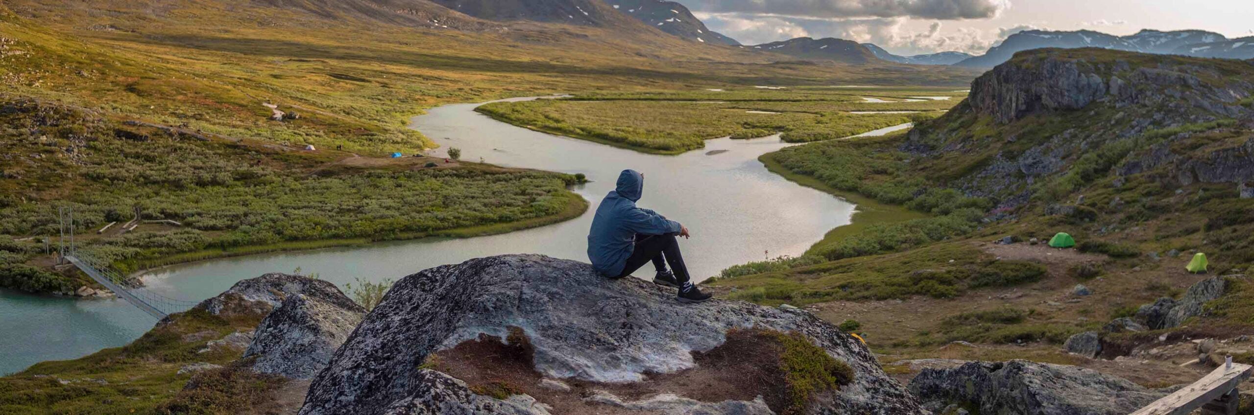
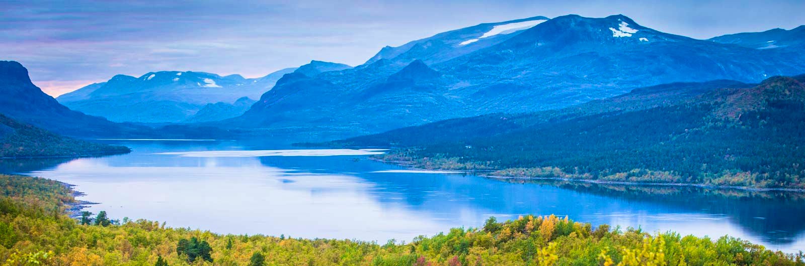
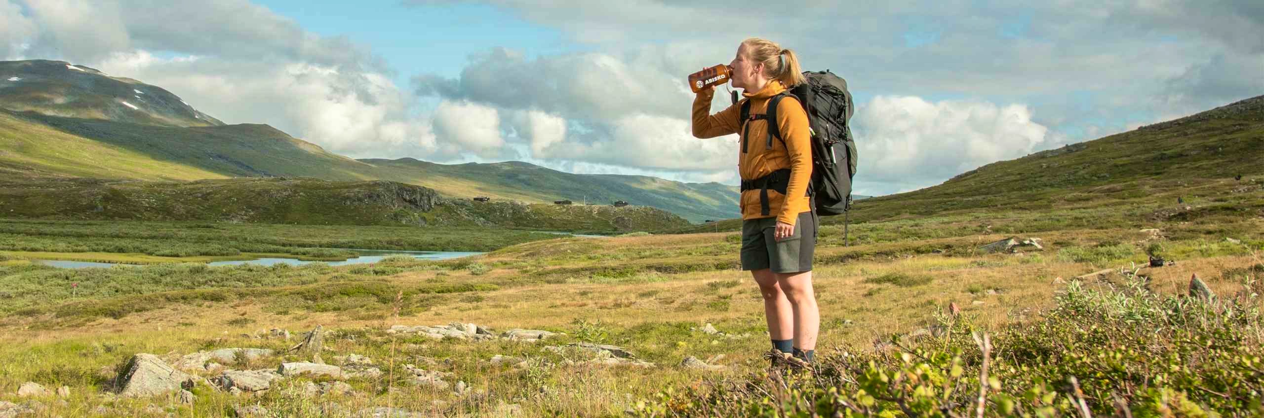
Already on the first day, the journey begins spectacularly as the hike starts in Abisko National Park. Dense mountain birch forest surrounds the trail at first. The green, rushing waters of the Abiskojåkka river can be heard and seen to the right, while slightly to the left you catch a glimpse of one of the most iconic silhouettes in the mountains, Lapporten. The further you go, the more barren the landscape becomes. Vast, beautiful views and rolling alpine heaths framed by high mountains await for many kilometers.
At both mountain stations and mountain huts, there are kitchens and small shops (not in Tjäktja and Singi), so plan your food supplies accordingly. The mountain stations also have restaurants. All accommodations are located directly along the trail. During the last two days of hiking, you leave Kungsleden to reach Nikkaluokta, from where buses run to Kiruna.
When hiking from Abisko to Nikkaluokta, you follow the well-known Kungsleden for most of the route. However, the section between Singi and Nikkaluokta is not part of the official Kungsleden. Despite this, it is a popular stretch as it provides access to the northern part of the trail and offers stunning scenery.
The stretch between Abisko and Nikkaluokta has been selected as one of STF’s Signature Trails – particularly scenic and quality-assured multi-day hikes.

Kungsleden Abisko in short
Map of Kungsleden Abisko-Nikkaluokta
Navigate past map or other external content.This map is a planning tool and should not replace a physical map and compass. The service “Naturkartan” (opens in new tab) is operated by a company called “Outdoor map”. Please note that trail information is owned and updated by the respective trail administrator (e.g. municipality or county administrative board).
Getting to the trail
The train stops daily right opposite Abisko Tourist Station, where the Kungsleden begins. From Kiruna, you can also travel by taxi, bus, or transfer. Read more at Visitabisko.com (opens in new tab) and Visitkiruna.com (opens in new tab). The route between Kiruna and Nikkaluokta is served by bus – see Nikkaluoktaexpressen.se (opens in new tab) for more information.
Don’t miss
Stay an extra night at Kebnekaise Mountain Station to climb Sweden’s highest mountain. Guided tours depart daily. At Alesjaure, you have the option to hike via the Vistas and Nallo huts instead of following the Kungsleden to Sälka.
Book the full route Abisko–Nikkaluokta
If you want to book multiple accommodations in one booking, the easiest way is to open each property in separate tabs in your browser. Then select dates and number of guests for each accommodation and proceed until you see that it has been added to your cart. All your selections are saved in the same cart, even if you are working in different tabs. When you’re ready to pay, proceed to checkout in any of the tabs – all your selections will be included. Your selections are saved for a total of 30 minutes.
Tip! Start by checking availability at STF Tjäktja Mountain Hut, as it has the fewest beds. You can also choose to skip Tjäktja and instead hike Alesjaure–Sälka / Sälka–Alesjaure, which is then 25 km.
Stages Abisko–Nikkaluokta
Stage 1: Abisko–Abiskojaure
15 km, 4–6 hours of hiking
Accomodation: STF Abiskojaure Mountain cabin
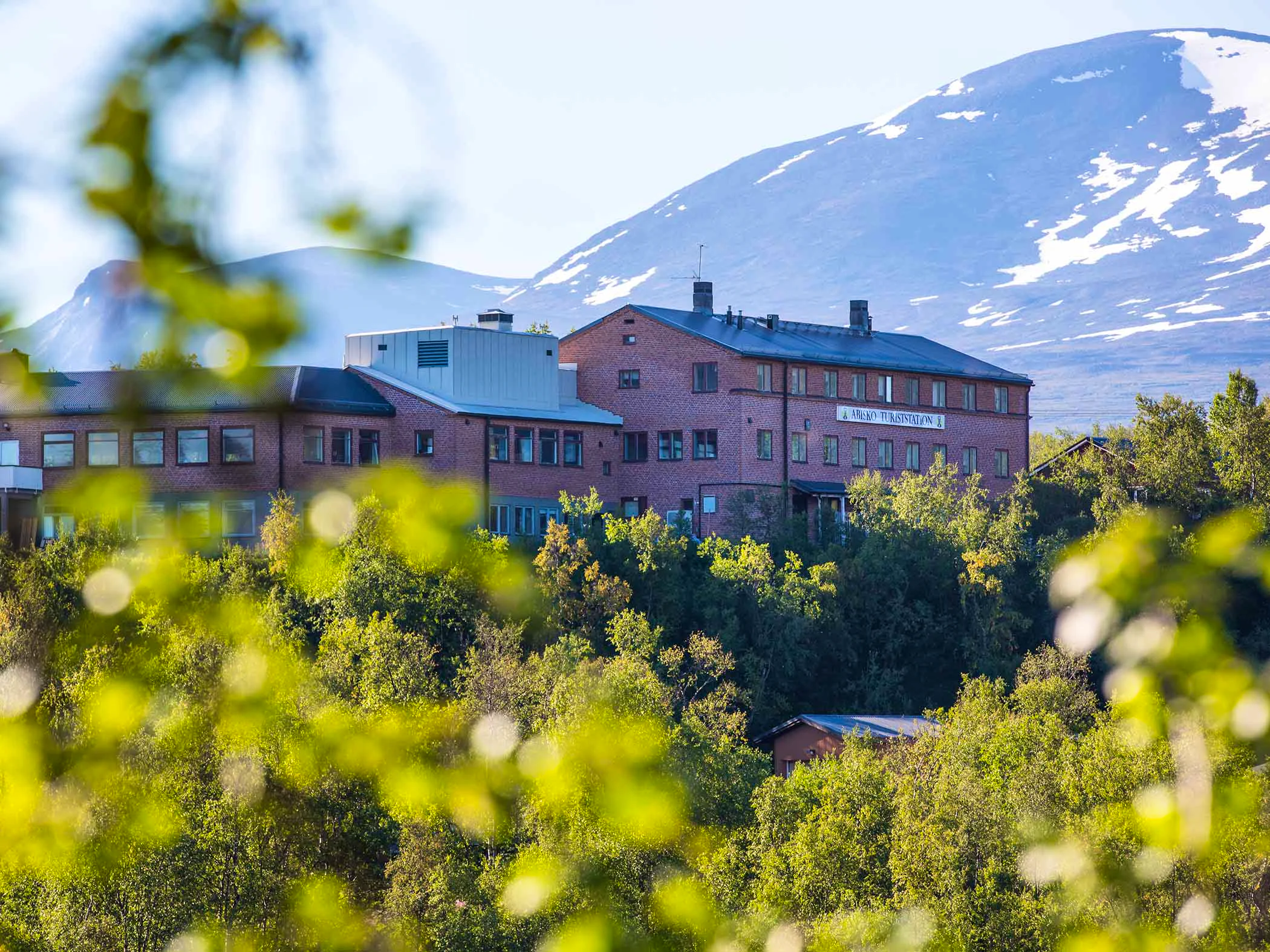
Tip! Stay one night at STF Abisko Turiststation before starting your hike.
You enter Abisko National Park on your very first day. Dense mountain birch forest surrounds the trail at first, but the landscape gradually opens up. After a few kilometers, you reach a high limestone cliff with beautiful views over the Abiskojåkka river. From here, the trail climbs gently before leveling out. Near Abiskojaure, there is a sandy beach popular for a refreshing swim. Water can be collected from streams along the trail. STF Abiskojaure Mountain Hut has a mountain shop with a Large selection.
Stage 2: Abiskojaure–Alesjaure
21 km, 6–8 hours of hiking
Accomodation: STF Alesjaure Mountain cabin
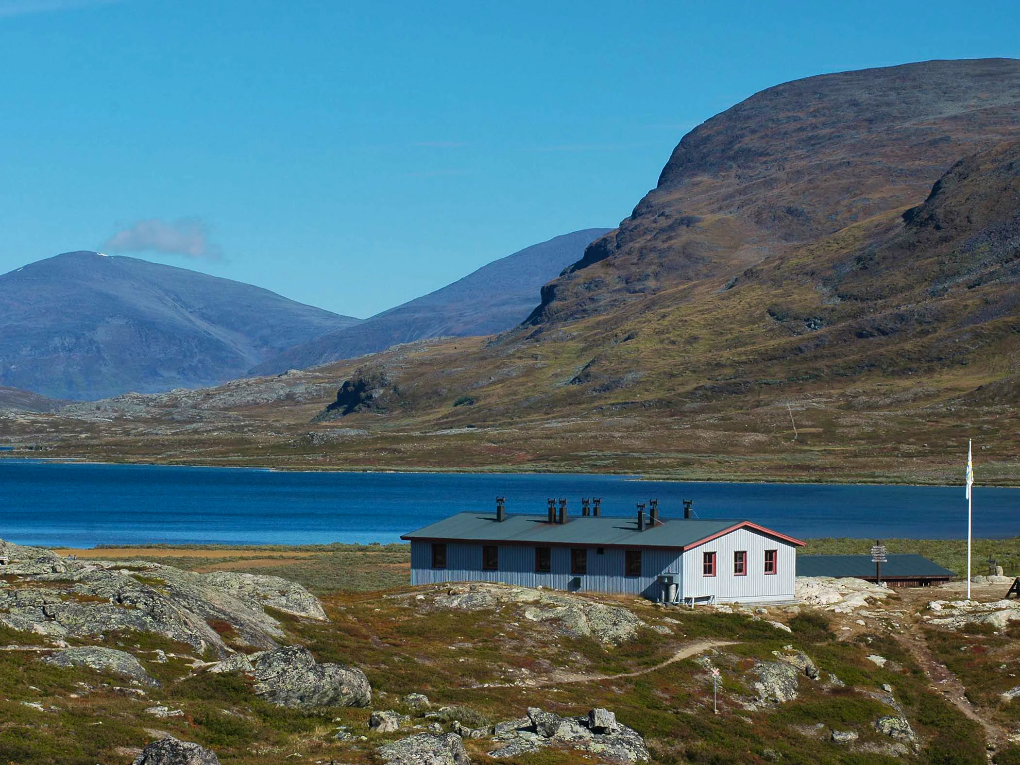
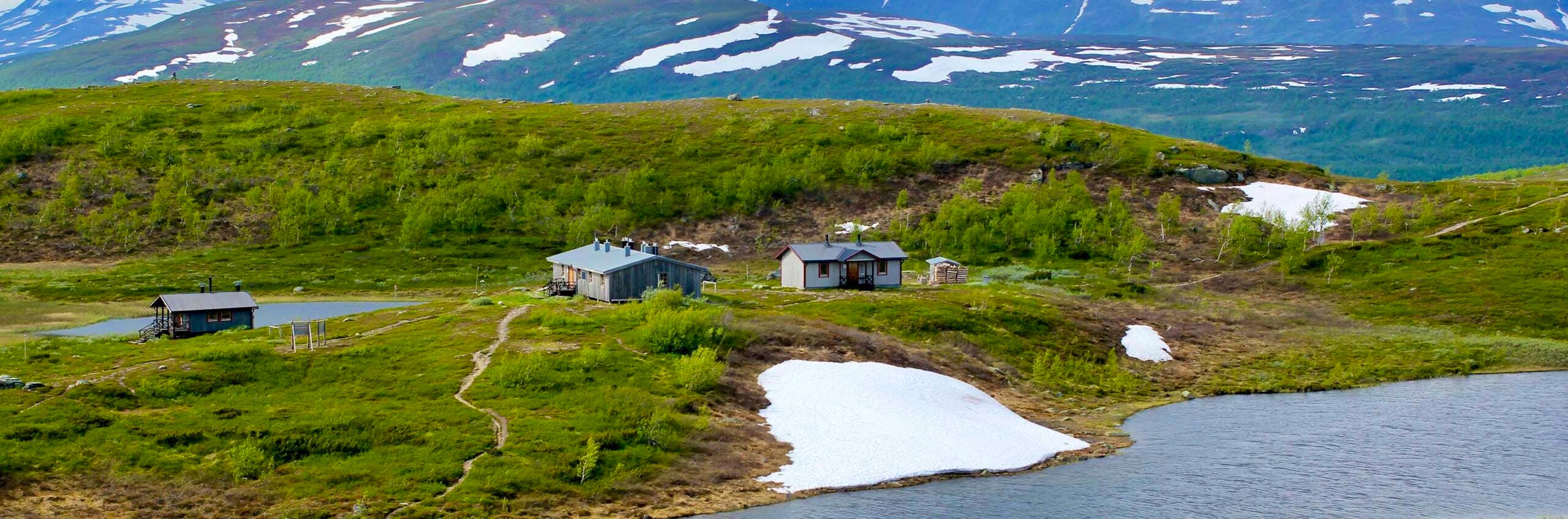
You leave the mountain birch forest behind and hike up onto the open alpine terrain. After a steep climb at Kieronbacken, the trail continues across grassy and heath-covered ground. You pass a series of green-tinted mountain lakes, with high peaks in view. If you want to shorten the hike by six kilometers, you can take the boat across Lake Alesjaure. Read our guide to boats in the mountains. The huts are located at the southern end of the lake. Water can be collected from streams along the trail. STF Alesjaure Mountain cabin has a mountain shop with a Large selection.
Stage 3: Alesjaure–Tjäktja
13 km, 4–5 hours of hiking
Accomodation: STF Tjäktja Mountain cabin
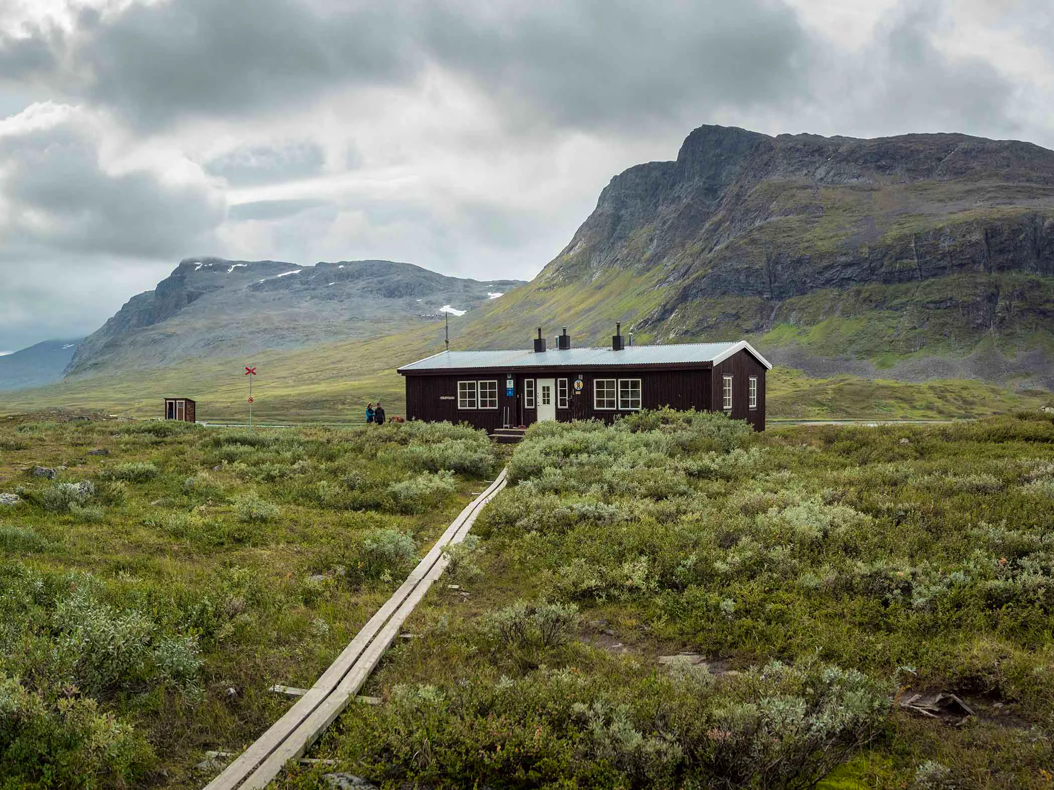
This stretch passes through a lush delta landscape where the wide Alesätno river winds its way forward. The trail continues gently uphill across heaths and meadows. The terrain is easy to walk until the final kilometers, where it becomes steeper and rockier. Water can be collected from streams along the trail. STF Tjäktja Mountain Hut has no shop, so you need to carry your own food.
Stage 4: Tjäktja–Sälka
12 km, 3–5 hours of hiking
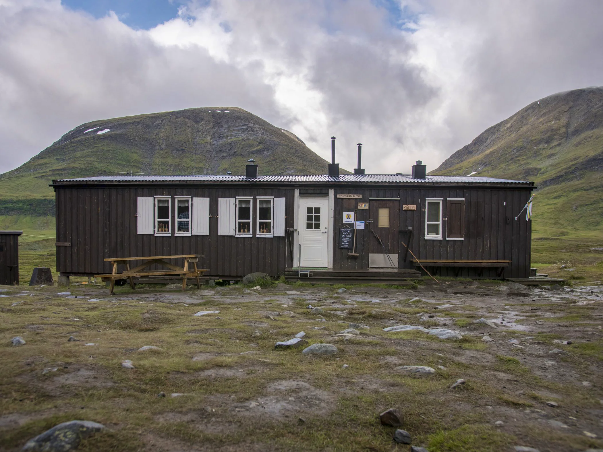
Accomodation: STF Sälka Mountain cabin
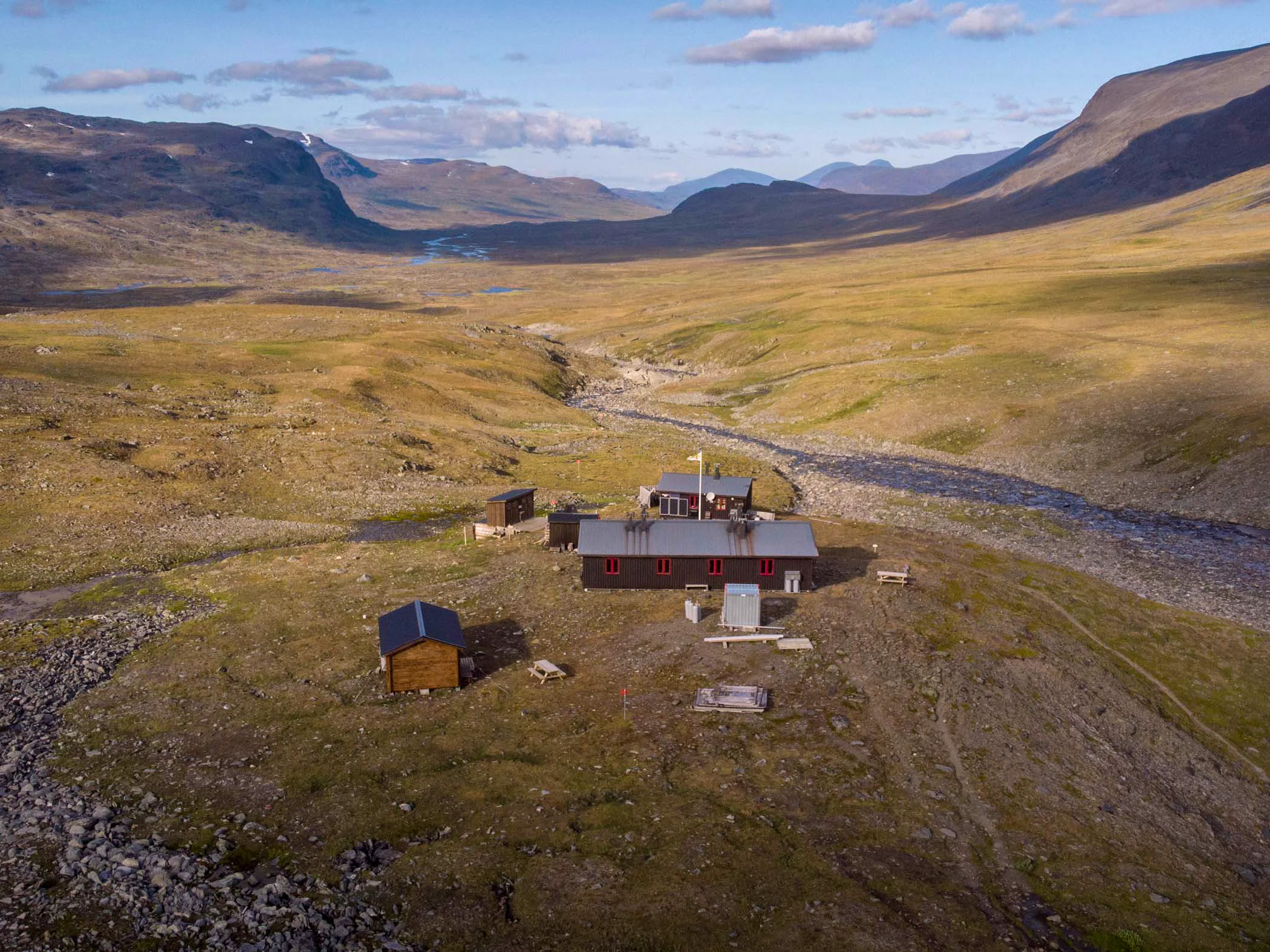
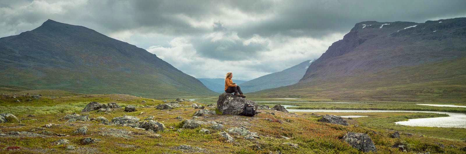
After four kilometers, you reach the highest point of the Kungsleden, Tjäktjapasset, at 1,150 meters above sea level. There is a shelter here. On the way down, the rocky terrain gives way to greener surroundings. As you descend into the impressive Tjäktjavagge valley, the landscape becomes increasingly lush. The valley stretches for 30 km and is surrounded by high mountains. Water can be collected from streams along the trail. STF Sälka Mountain Hut has a mountain shop with a Large selection.
Stage 5: Sälka–Singi
12 km, 3–4 hours of hiking
Accomodation: STF Singi Mountain cabin
The hike continues through Tjäktjavagge as the valley widens and the terrain remains easy to walk. High mountains, steep cliffs, and glaciers line your path across fertile alpine heaths. There is a shelter at Kuoperjåkka. You cross many streams and wooden bridges. Just before Singi, the trail becomes more winding and rocky. This stretch may be one of the most beautiful in Sweden—depending on who you ask! Water can be collected from streams along the trail. STF Singi Mountain Hut has no shop, so you need to carry your own food.
Stage 6: Singi–Kebnekaise
15 km, 4–5 hours of hiking
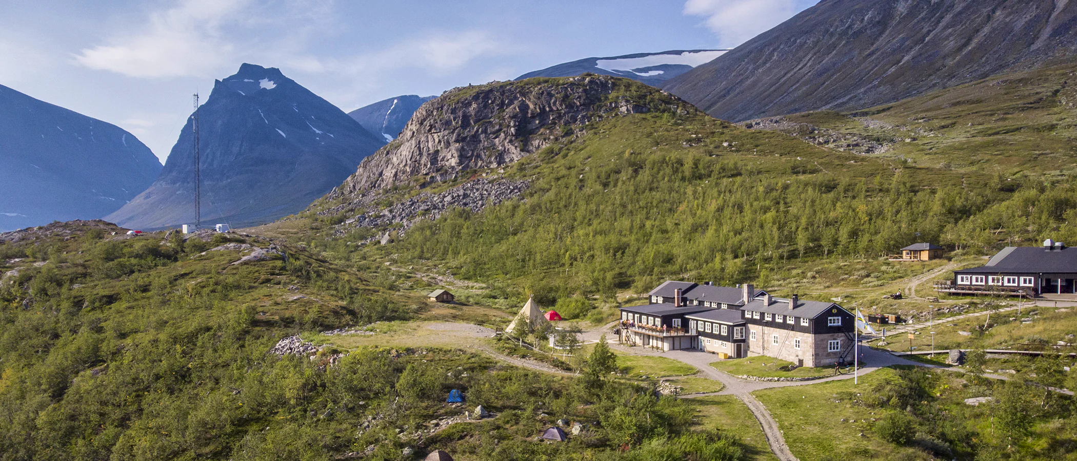
Accomodation: STF Kebnekaise Mountain station
At Singi, you leave the Kungsleden on your way to Kebnekaise Mountain Station. The day begins with an uphill hike into the Laddjuvagge valley. The scenery becomes dramatic again, with steep mountain sides surrounding the trail. The path gradually slopes downward, and the landscape opens up as you descend. After a few kilometers on flatter ground, you’ll see the striking peak of Tuolpagorni. The final kilometers traverse rocky terrain. Water can be collected from streams along the trail. STF Kebnekaise Mountain Station offers a shop, self-catering facilities, and a restaurant with a full license.
Stage 7: Kebnekaise–Nikkaluokta
19 km, 5–7 hours of hiking
Accomodation: Nikkaluokta (opens in new tab), not an STF accommodation – membership discounts do not apply and booking is not available via STF.
This stretch takes you back into mountain birch forest. The terrain is partly rocky, with boardwalks across wet or difficult sections. During summer, you can take a boat across Lake Laddujavri, shortening the hike by six kilometers. At the jetty, there is a traditional hut serving coffee as well as Lap Dånalds, where you can try reindeer burgers.
After the boat crossing, five kilometers remain to the village of Nikkaluokta, where there is a shop and restaurant. From Nikkaluokta, buses run daily to Kiruna railway station. Water can be collected from streams along the trail.
Recharge or relax before or after your hike at STF Kiruna Hotel & Hostel and STF Abisko Turistation.
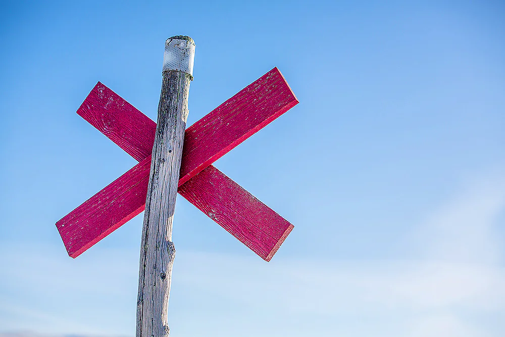
Trail markings
Check the trail markings before you set out. Winter trails are marked with crosses, while summer trails are marked with painted poles, stones, or trees. Winter trails can be difficult to follow in summer, so use a map and trail signs to navigate.
Read more about the trail systemAccomodations along the trai

Visitor calendar
Do you prefer a quieter experience in the mountains? Our visitor calendar gives you an overview of typical occupancy levels in this mountain area, helping you plan your trip during less busy periods. During quieter times, we also often offer better prices. Please note that the visitor calendar is only an indication and does not account for variations due to events or holidays.
Week |
24 |
25 |
26 |
27 |
28 |
29 |
30 |
31 |
32 |
33 |
34 |
35 |
36 |
37 |
38 |
39 |
|---|---|---|---|---|---|---|---|---|---|---|---|---|---|---|---|---|
Abisko |
Few visitors |
More visitors Thurs-Sat |
Few visitors |
Few visitors |
Most visitors |
Most visitors |
Most visitors |
Most visitors |
Most visitors |
Most visitors |
More visitors Thurs-Sat |
More visitors Thurs-Sat |
More visitors Thurs-Sat |
More visitors Thurs-Sat |
Few visitors |
Few visitors |
Kebnekaise |
Few visitors |
More visitors Thurs-Sat |
More visitors |
More visitors |
Most visitors |
Most visitors |
Most visitors |
Most visitors |
Most visitors |
Most visitors |
Most visitors |
Most visitors |
More visitors Thurs-Sat |
More visitors Thurs-Sat |
Few visitors |
Closed |
Tarfala |
Closed |
Closed |
Few visitors |
Few visitors |
Few visitors |
Few visitors |
Most visitors |
Most visitors |
More visitors |
More visitors |
Few visitors |
Few visitors |
Few visitors |
Closed |
Closed |
Closed |
Abiskojaure |
Closed |
Few visitors |
Few visitors |
Few visitors |
Few visitors |
Few visitors |
Most visitors |
Most visitors |
More visitors |
More visitors |
Few visitors |
Few visitors |
Few visitors |
Few visitors |
Closed |
Closed |
Nallo |
Closed |
Closed |
Few visitors |
Few visitors |
Few visitors |
Few visitors |
Most visitors |
Most visitors |
More visitors |
More visitors |
Few visitors |
Few visitors |
Few visitors |
Closed |
Closed |
Closed |
Alesjaure |
Closed |
Few visitors |
Few visitors |
Few visitors |
Most visitors |
Most visitors |
Most visitors |
Most visitors |
More visitors |
More visitors |
Few visitors |
Few visitors |
Few visitors |
Few visitors |
Closed |
Closed |
Kårsavagge |
Closed |
Few visitors |
Few visitors |
Few visitors |
Most visitors |
Most visitors |
Most visitors |
Most visitors |
More visitors |
More visitors |
Few visitors |
Few visitors |
Few visitors |
Closed |
Closed |
Closed |
Singi |
Closed |
Few visitors |
Few visitors |
Few visitors |
Most visitors |
Most visitors |
Most visitors |
Most visitors |
More visitors |
More visitors |
Few visitors |
Few visitors |
Few visitors |
Few visitors |
Closed |
Closed |
Sälka |
Closed |
Few visitors |
Few visitors |
Few visitors |
Most visitors |
Most visitors |
Most visitors |
Most visitors |
More visitors |
More visitors |
Few visitors |
Few visitors |
Few visitors |
Few visitors |
Closed |
Closed |
Unna Allakas |
Closed |
Closed |
Few visitors |
Few visitors |
More visitors |
More visitors |
More visitors |
More visitors |
More visitors |
More visitors |
Few visitors |
Few visitors |
Few visitors |
Closed |
Closed |
Closed |
Tjäktja |
Closed |
Few visitors |
Few visitors |
Few visitors |
Most visitors |
Most visitors |
Most visitors |
Most visitors |
More visitors |
More visitors |
Few visitors |
Few visitors |
Few visitors |
Few visitors |
Closed |
Closed |
Vistas |
Closed |
Closed |
Few visitors |
Few visitors |
More visitors |
More visitors |
More visitors |
More visitors |
More visitors |
More visitors |
Few visitors |
Few visitors |
Few visitors |
Closed |
Closed |
Closed |
Sitasjaure |
Closed |
Closed |
Closed |
Few visitors |
Few visitors |
Few visitors |
Few visitors |
Few visitors |
Few visitors |
Few visitors |
Few visitors |
Few visitors |
Few visitors |
Closed |
Closed |
Closed |
Pältsa |
Closed |
Closed |
Few visitors |
Few visitors |
Few visitors |
Few visitors |
Few visitors |
Few visitors |
Few visitors |
Few visitors |
Few visitors |
Few visitors |
Few visitors |
Few visitors |
Closed |
Closed |
Hukejaure |
Closed |
Closed |
Closed |
Few visitors |
Few visitors |
Few visitors |
Few visitors |
Few visitors |
Few visitors |
Few visitors |
Few visitors |
Few visitors |
Few visitors |
Closed |
Closed |
Closed |
Read more about Kungsleden
Kungsleden Saltoluokta – Kvikkjokk
The stretch between Saltoluokta and Kvikkjokk is just over 70 kilometers long and offers striking contrasts.
Kungsleden Nikkaluokta – Saltoluokta
Experience one of Sweden’s most classic mountain hikes on the Kungsleden between Nikkaluokta and Saltoluokta.
Kungsleden Kvikkjokk – Ammarnäs
The stretch between Kvikkjokk and Ammarnäs is the least hiked part of the Kungsleden and offers a शांत and magnificent experience. Here, you’ll find impressive views, especially in Pieljekaise National Park and the Vindelfjällen Nature Reserve, where vast mountain landscapes and deep valleys unfold.
Kungsleden Ammarnäs–Hemavan
The southern end of the Kungsleden is Hemavan. From here, you hike through the Vindelfjällen Nature Reserve – a Lapland in miniature.
Kungsleden Abisko–Nikkaluokta
This section describes the northern part of the 450 km-long Kungsleden, from Abisko to Nikkaluokta. A hike of 5–7 days.
Kungsleden
The Kungsleden Trail between Abisko and Hemavan is one of the world’s most famous – and perhaps finest – long-distance hiking routes.